The Great Northern Peninsula Bikepacking Loop

This is a 700 km mixed surface route with 10,000 meters of climbing which we did over an 8 day period in August 2020. We began the ride in Rocky Harbour and used Hwy 430 to get to Hawkes Bay. From there we used resource roads and the road created for the Muscrat Falls transmission line to cross The Great Northern Peninsula over to the White Bay area. We then headed west (mostly on resource roads) to get to Cormack and we continued west, staying north of Deer Lake to get to Hughes Brook. A very hilly Hwy 440 got us from Hughes Brook to beautiful Cox’s Cove where we picked up resource roads to get north to Glenburnie in the Bonne Bay/Gros Morne area. Hwy 431 took us to Trout River where we picked up a dirt road to take us to spectacular Chimney Cove. We backtracked on the last day to Woody Point and chartered a Zodiac to take us across Bonne Bay to Norris Point. A short uphill from there got us back to Rocky Harbour.

DAY ONE (Rocky Harbour to Hawkes Bay 170 km)

It was never my intention to ride from Rocky Harbour to Hawkes Bay in a day but we did. 160 km on the road, plus side trips to the boat launch at western Brook Pond and a few side trips off the main road made for a big day.

(L-R) Don, Malcolm, Darren and John.

It’s worth the side trip to Western Brook Pond.
There are some opportunities to get off the main road and ride a bit of dirt, such as picking up part of the Heritage Trail near Broom Point and following it to St. Paul’s. We picked it up again after St. Paul’s and rode it to Cow Head.
Another option to get offroad is to ride from Cow Head to Shallow Bay on the beach.

We spent the night at Torrent River Inn in Hawkes Bay. It was a great decision after such a big day. We were able to get food from the restaurant, there was a convenience store nearby, and in the morning we loaded up on coffee and breakfast sandwiches from Robin’s Coffee.

DAY 2 (80 km)

From Hawkes Bay we picked up resource roads and eventually picked up the road constructed to install the Muskrat Falls transmission line.

We were all smiles on the resource roads. A little less smiley once on the transmission line road. Lots of elevation gain, lots of VERY steep sections (20+ degrees!).
The transmission line road is very well constructed.

DAY 3 (85km)

Finding a decent place to camp was more challenging than you would think. You want to be near water, you want the ground to be relatively flat and level. We ended up pitching at the base of one of the transmission line towers. Great choice, until a thunder and lightning storm rolled in during the middle of the night and all I could think about was a lightning strike on the tower…
The morning after the lightning storm.
Lots of up and down.
We’re at the headwaters of the Main River here. Earlier in the season Darren (pictured) began a canoe trip down the Main River at this point.
Cooling off.

DAY 4 (105 km)

We camped beside the Humber River near where Taylors Brook Road meets Hwy 420. We followed resource roads to Sir Richard Squires Park, some pavement to Cormack, then back onto resource roads north of Deer Lake, eventually camping beside the lake itself.

Big Falls.
Busy beavers north of Deer Lake.
Be mindful that you are in bear country. Cache/hang your food away from your tent each night.
Our campsite beside Deer Lake.

DAY 5 (85 km, a shitload of climbing)

We biked from our campground beside Deer Lake to Frenchmans Pond. We began on resource roads (lots of climbing), then onto pavement (more climbing) and ended on resource roads east of Cox’s Cove.

Cox’s Cove.

DAY 6 (Frenchmans Pond to Glenburnie 75 km-ish)

We awoke to this. Not bad.
On the resource road between Hughes Brook and Glenburnie. Them’s the Tablelands in the background.

DAY 7 (Glenburnie to Chimney Covelosing track of distance at this point)

We biked the new trail down to Green Gardens. Hella fun on the way down, just plain hell on the climb back. But worth it – highly recommended.
On the road between Trout River and Chimney Cove.
Chimney Cove.
Chimney Cove – a fine place to spend the night.

DAY 8 (Chimney Cove to Woody Point, boat ride to Norris Point, bike to Rocky Harbourmaybe 45 km? Don’t care anymore as there is beer and food at the end)

Waking up in Chimney Cove is a great way to start the day.
Replacing calories in Woody Point.
We chartered a Zodiac to get us from Woody Point to Norris Point as the ferry wasn’t running this year (thanks Covid-19). Robbie at Gros Morne Adventures was there to get us across the bay. Great service, great communication, highly recommended.
All smiles at the end of the trip.

gros morne 2017

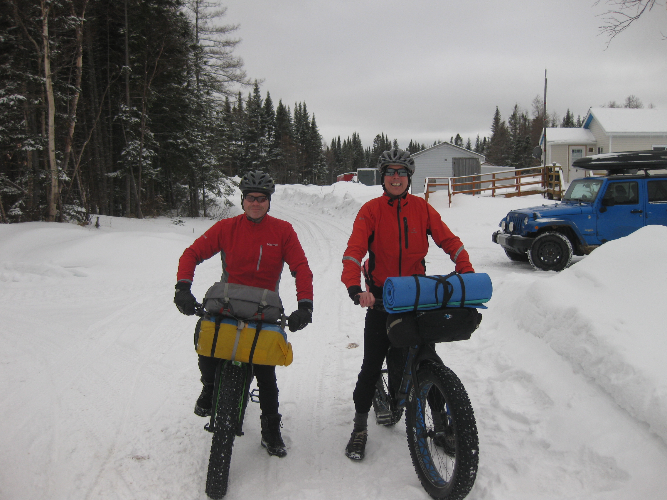
Darren and I headed out to Gros Morne again this year, further building on what we did and learned last year and the year before.

Main River

Sops Arm Loop

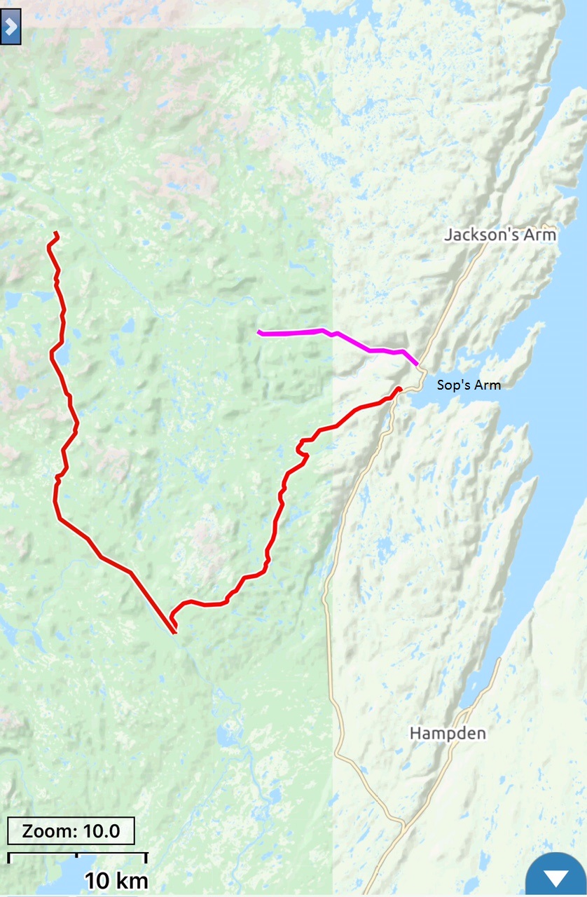
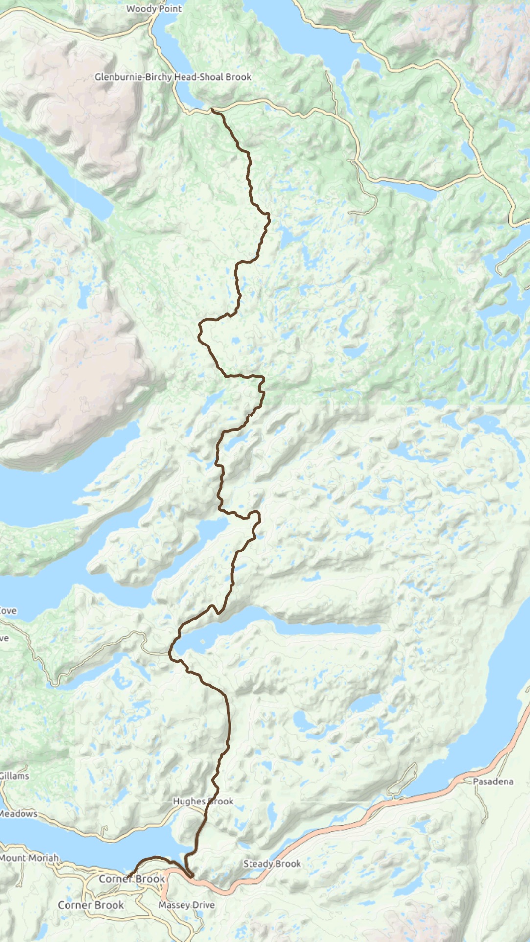
Our initial plan was to do a 3 day, 2 night loop (about 110 km) that incorporated riding up the Main River Road, then on to Eagle Mountain Road/Taylor’s Brook Road and back to the start in Sop’s Arm. But that area got socked by snow starting the night before we were to begin and it continued to snow for 48+ hours, with 50 cm falling altogether.  In the image above you can see how far we got (in pink, 13 km one way) on unloaded bikes.

Main R tracks

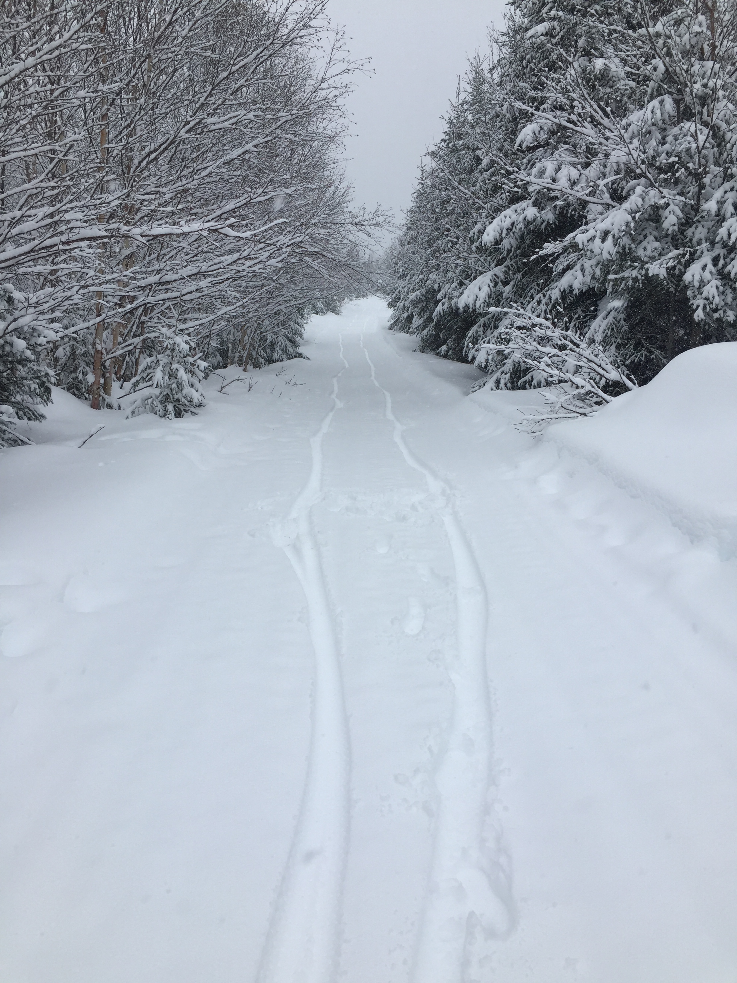
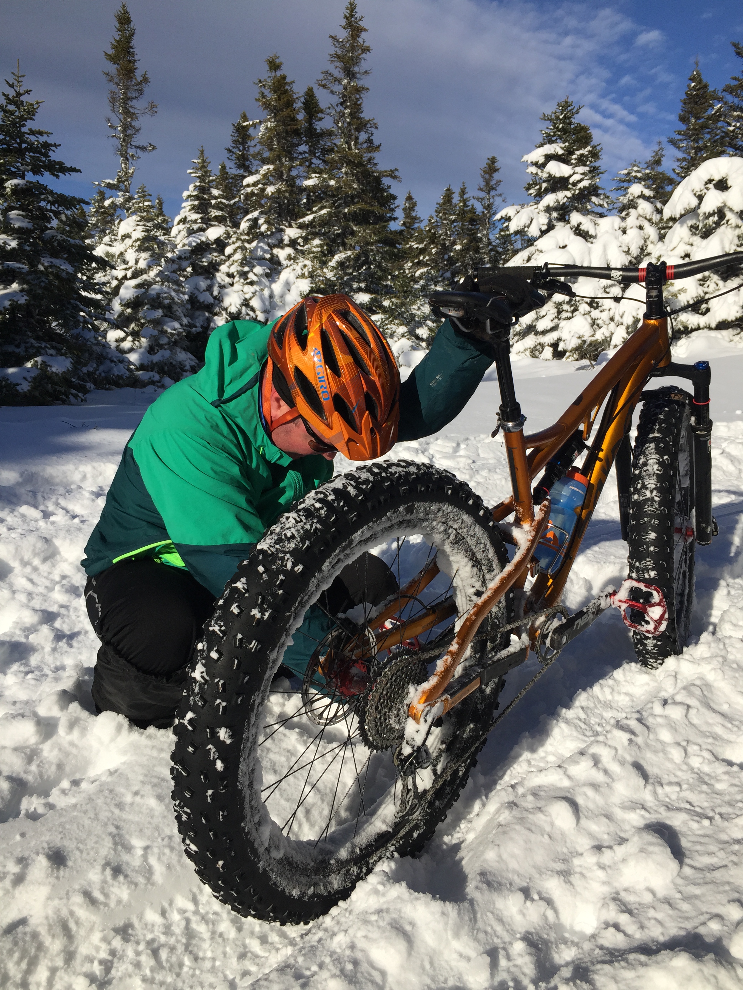
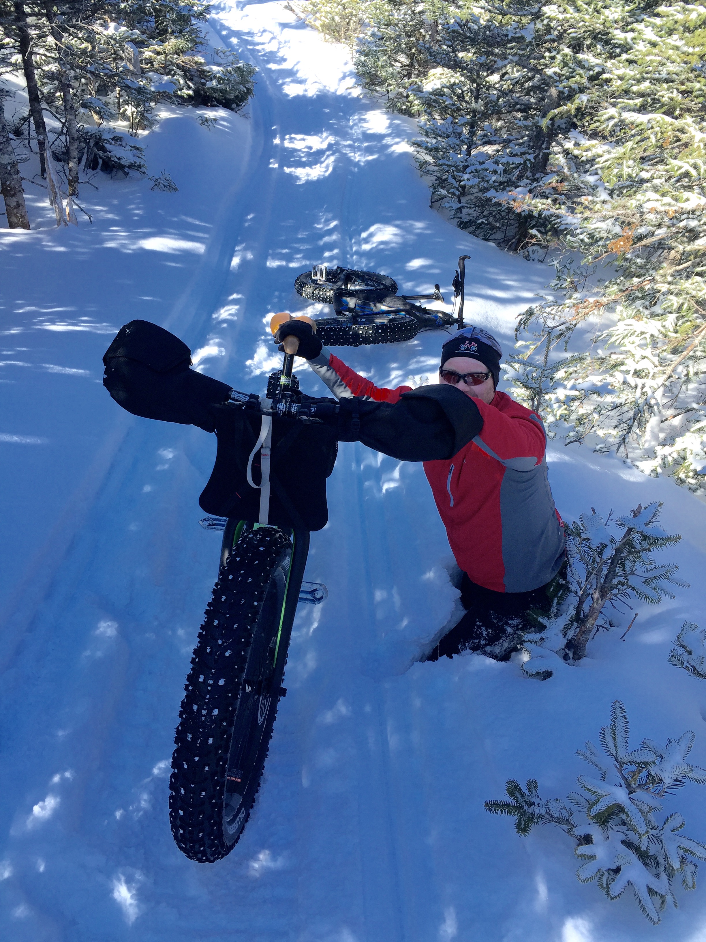
Lots of fresh snow on the Main River Road.

MR deep snow

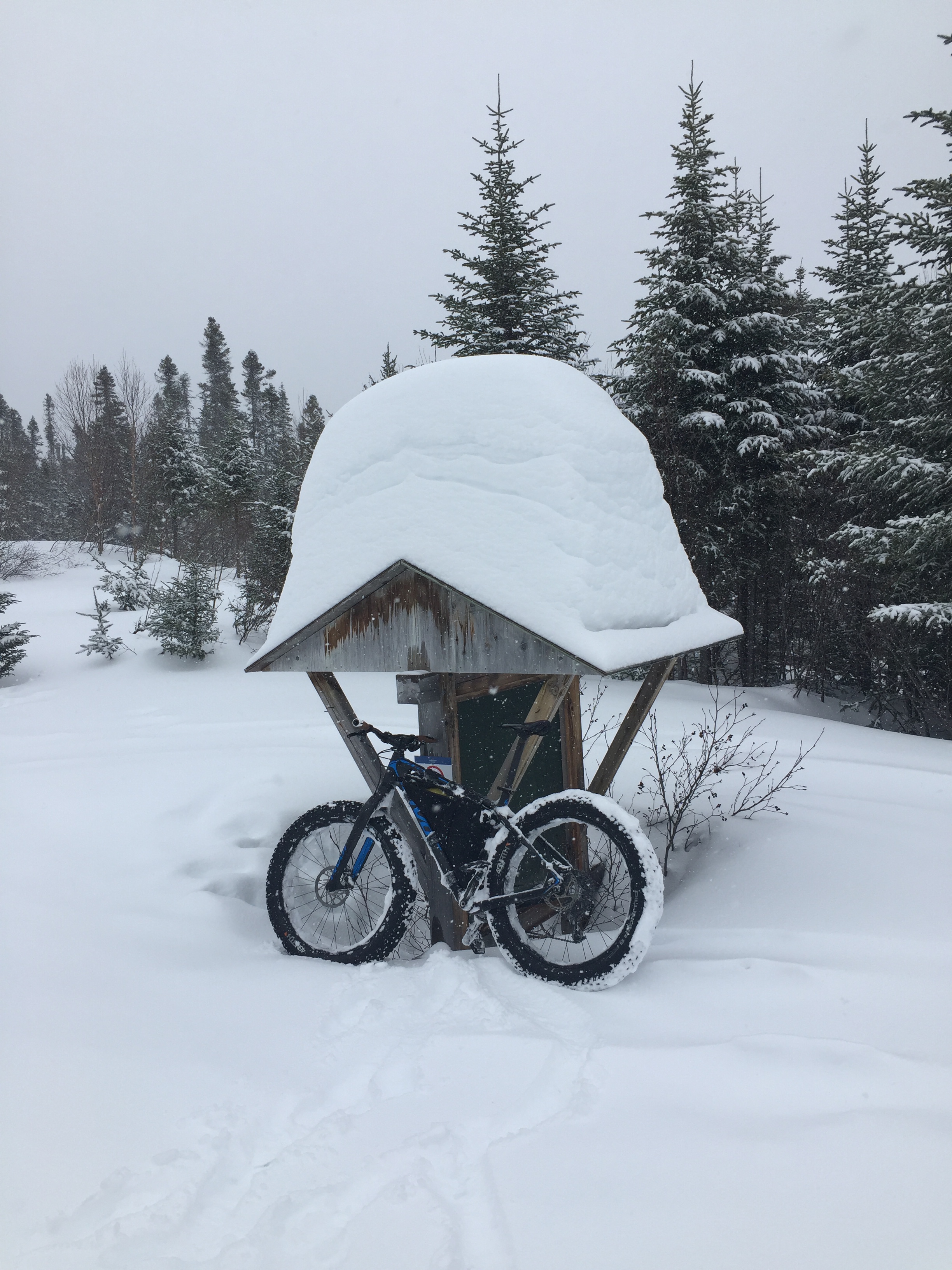
Here you can get a sense of just how much snow falls in this area.

Main River bridge

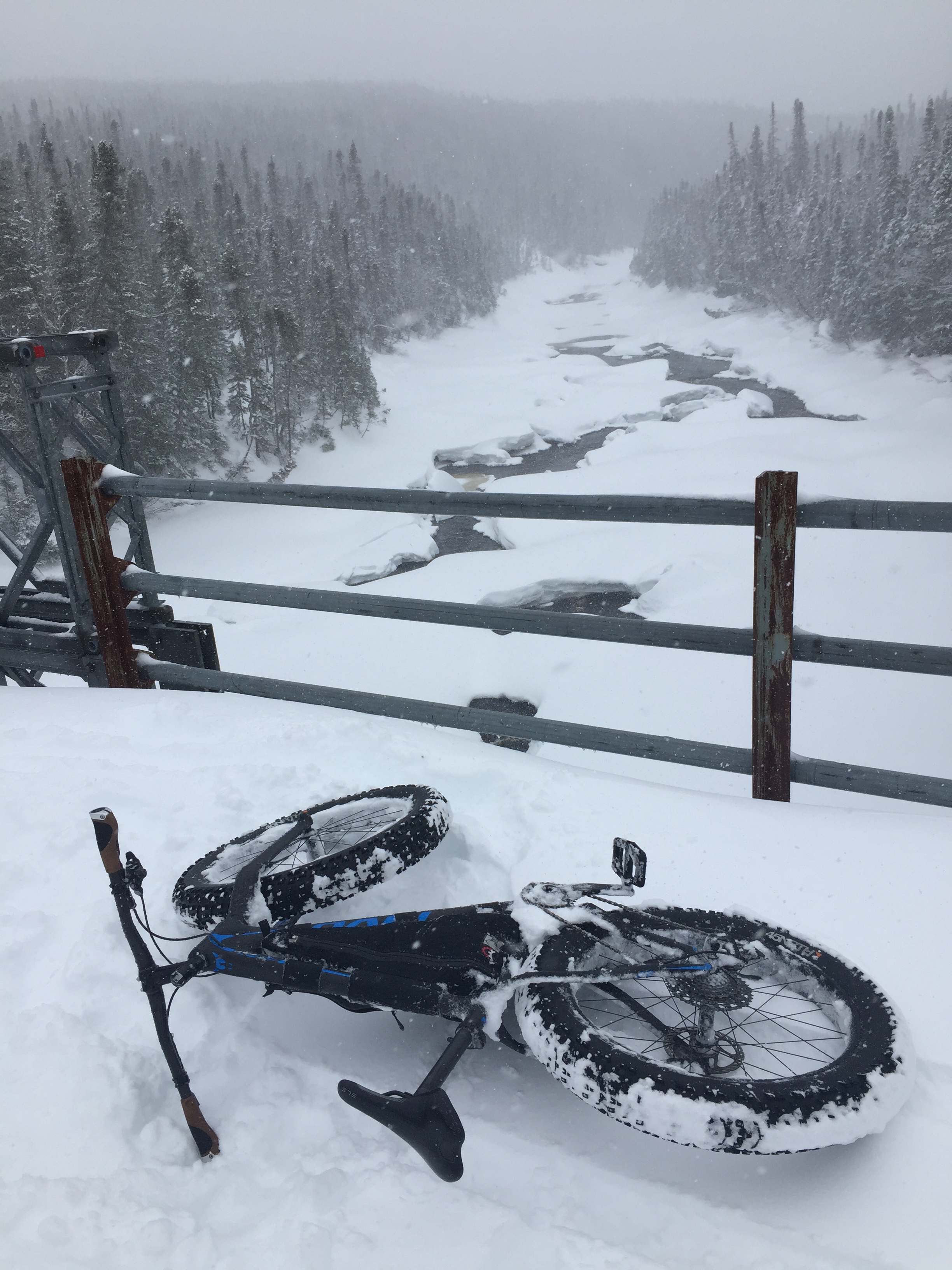
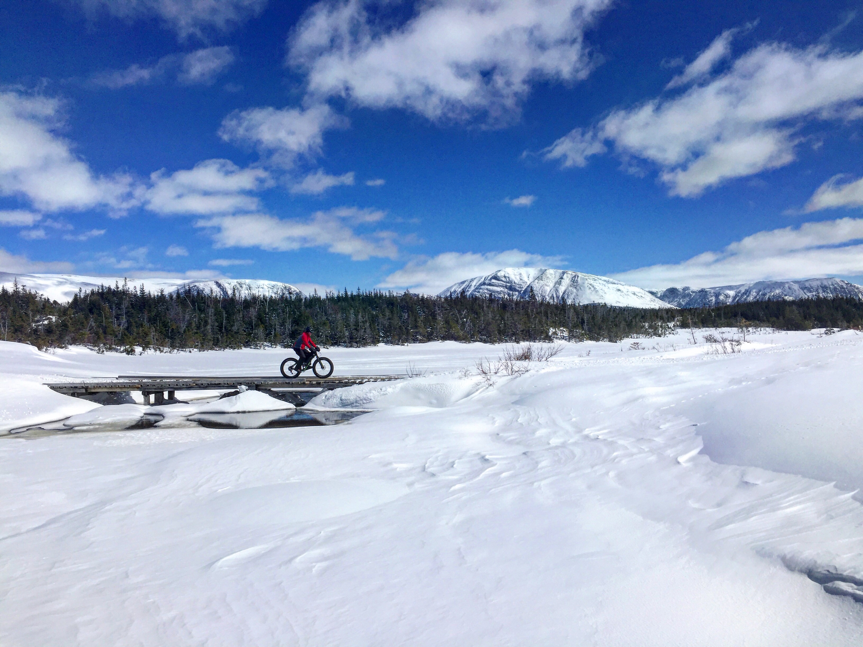
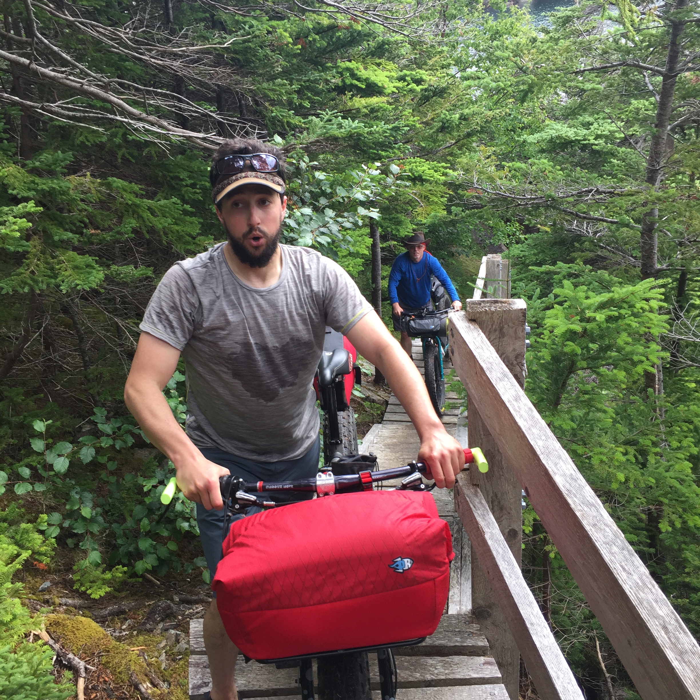
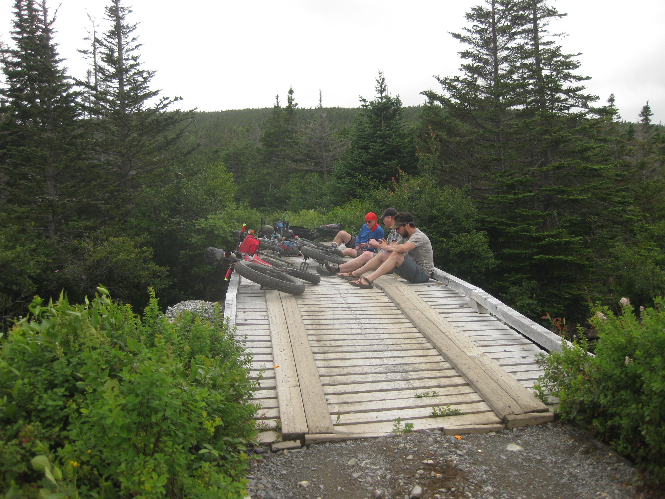
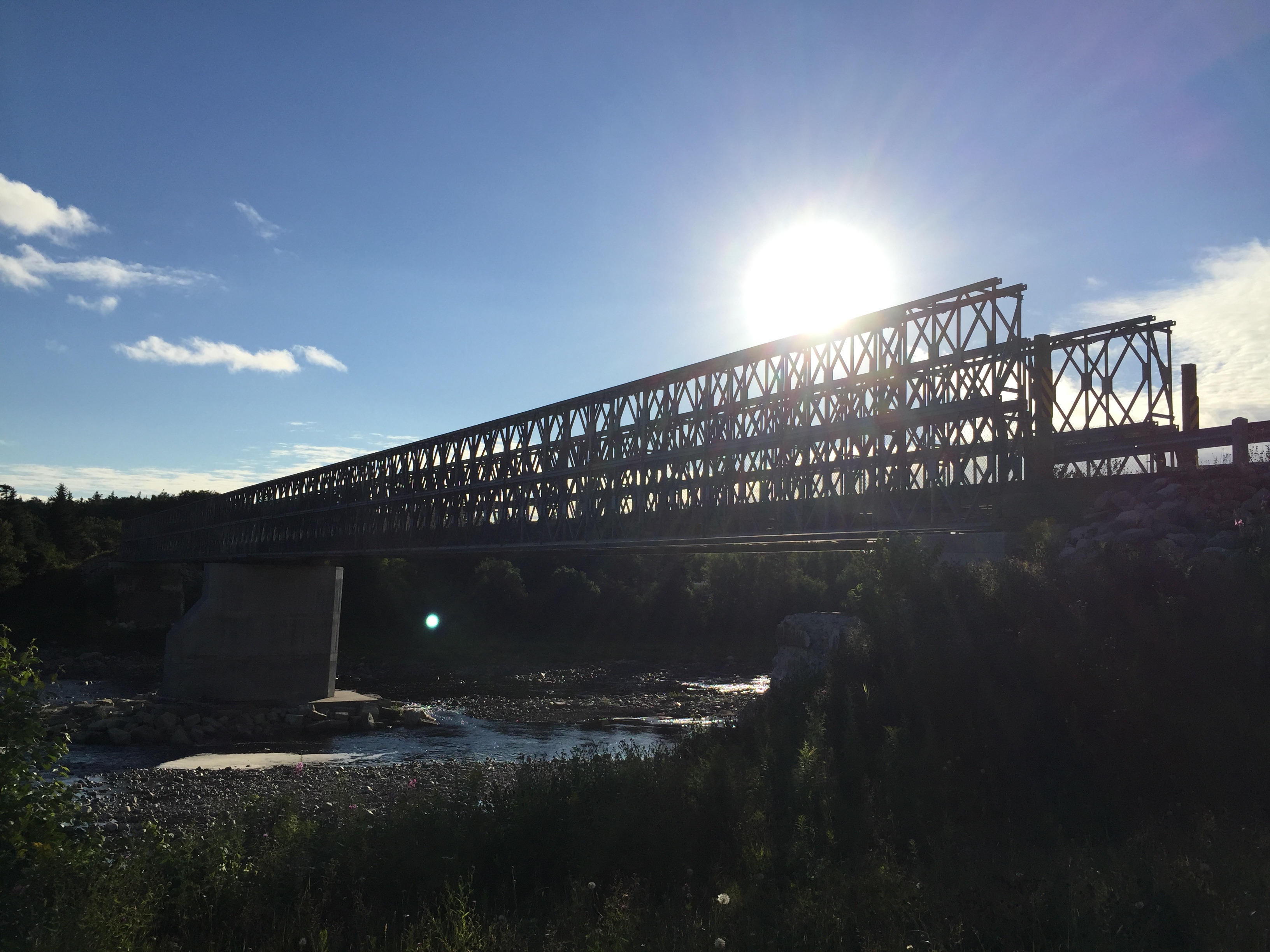
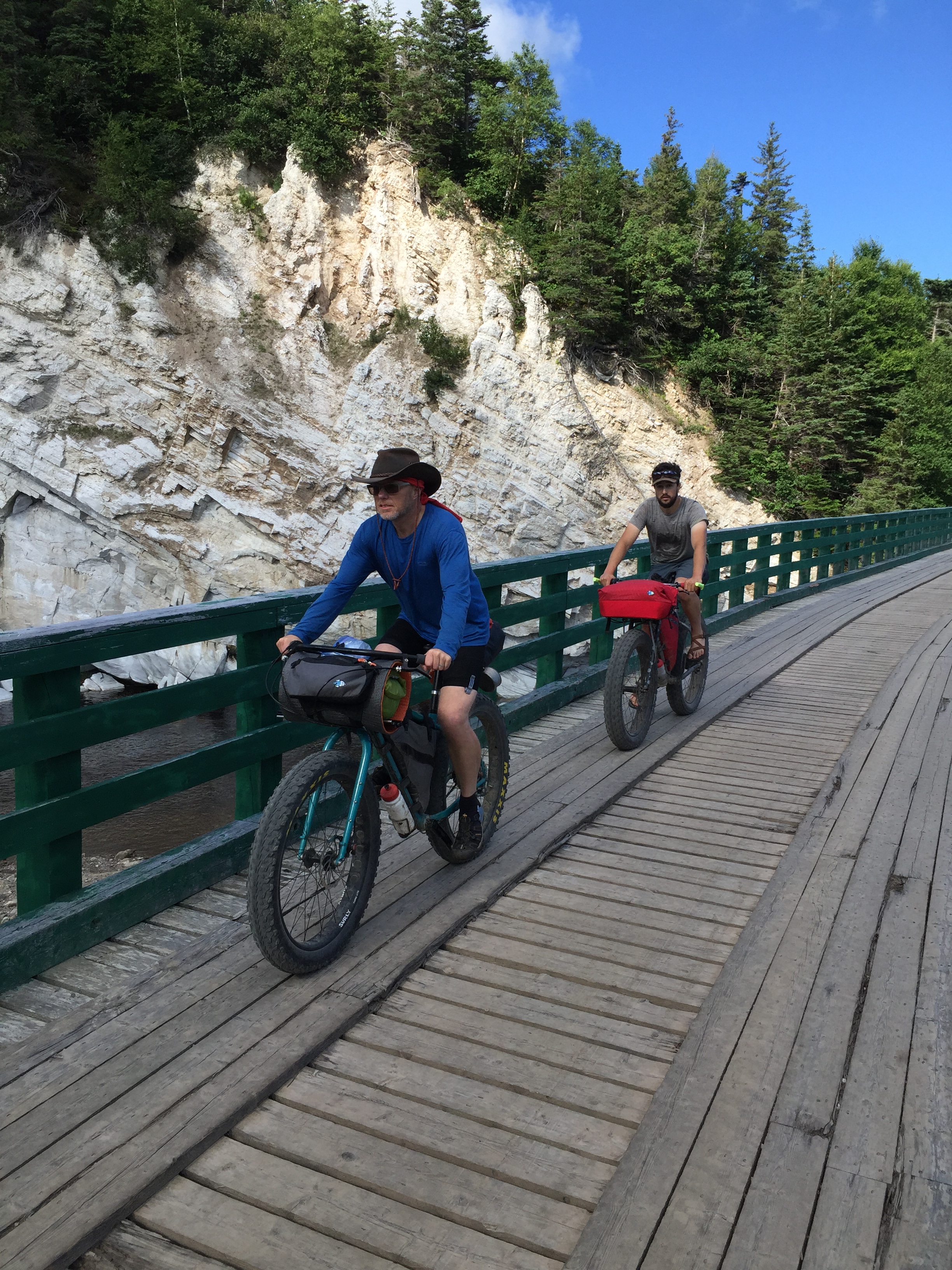
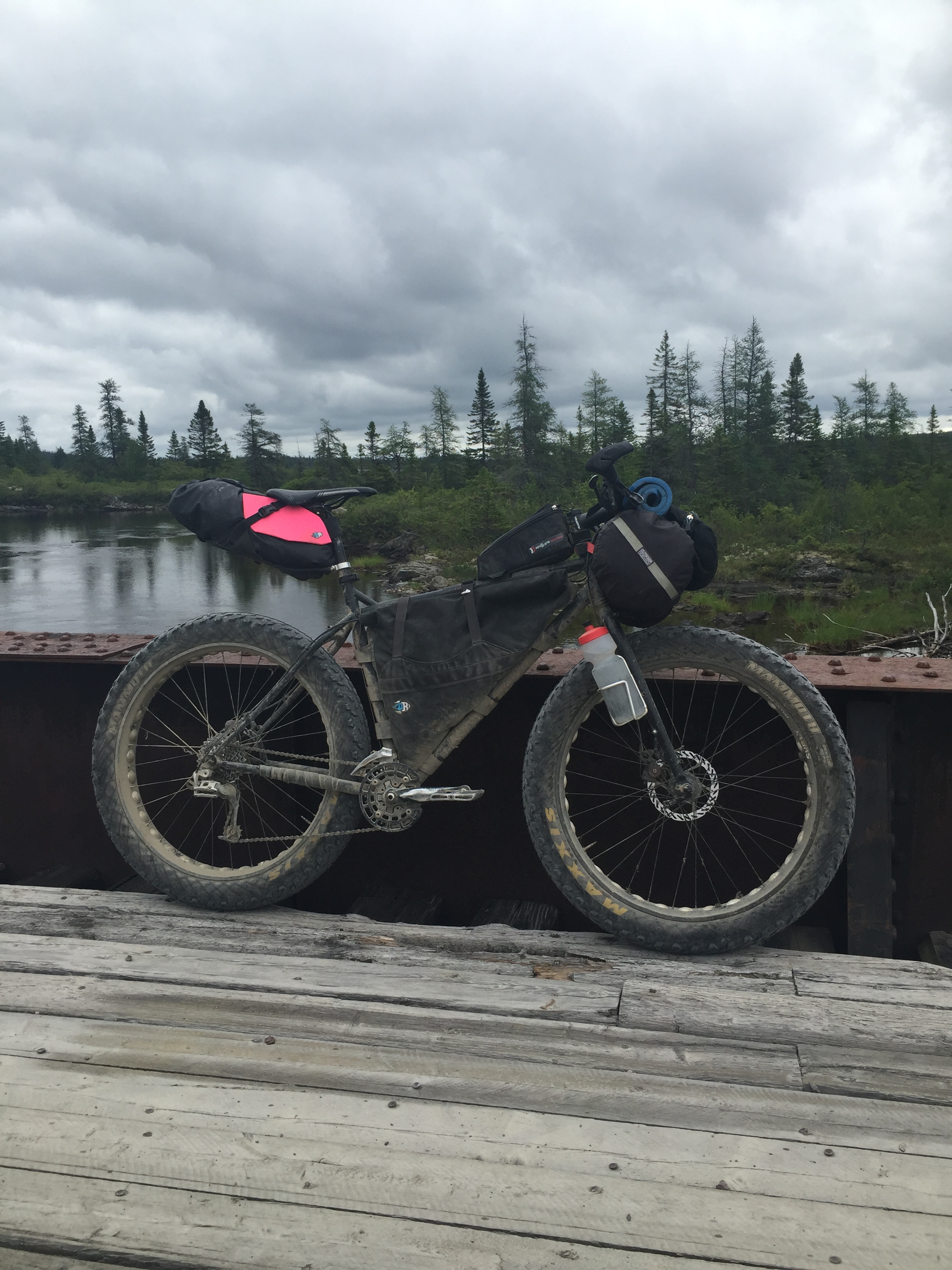
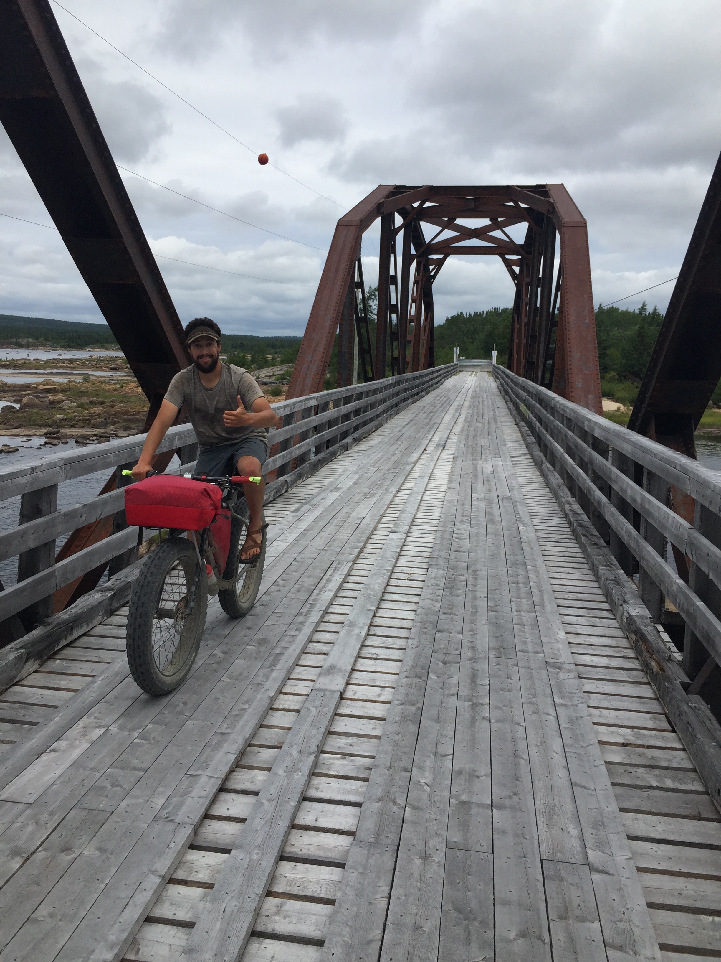
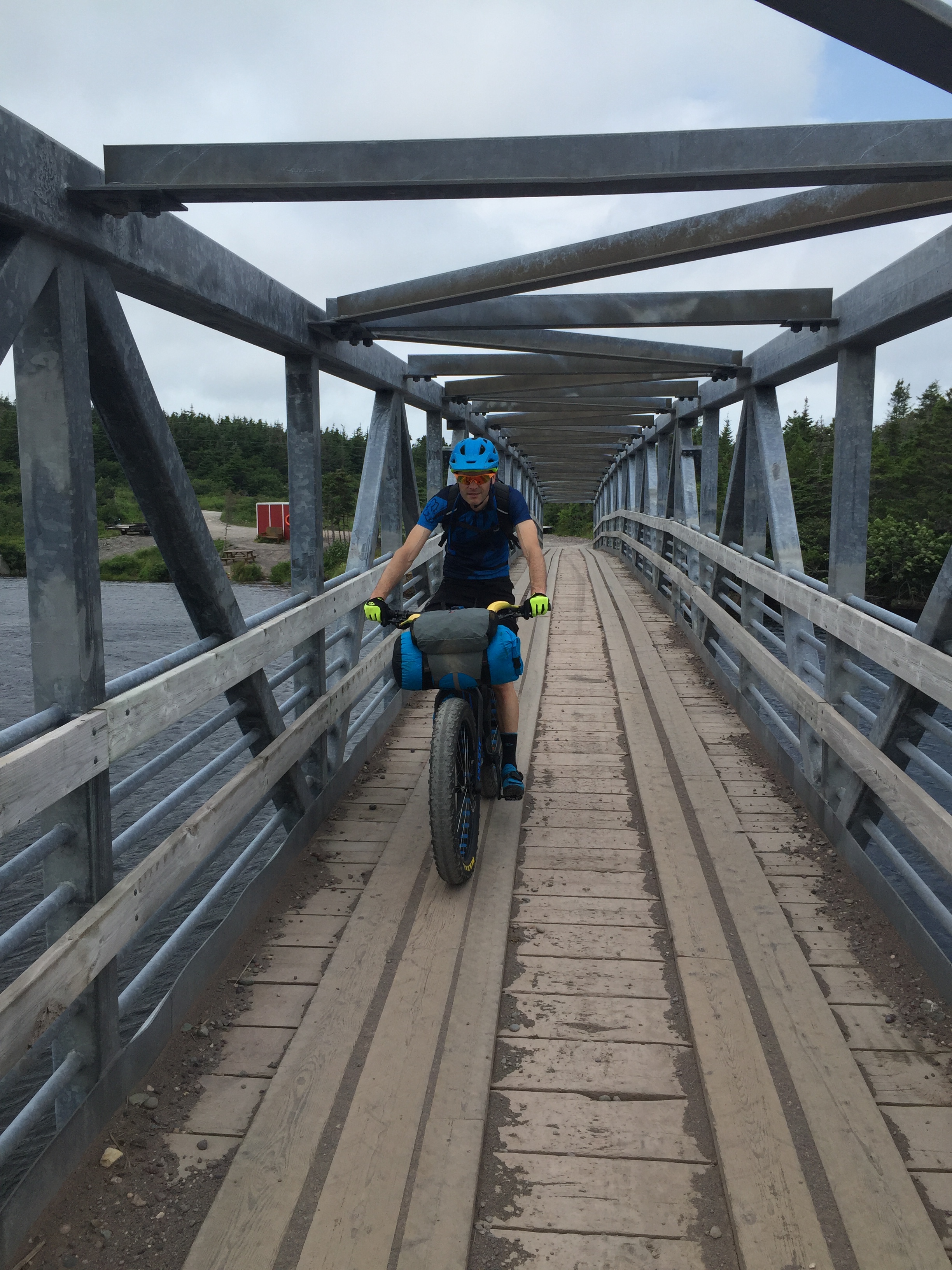
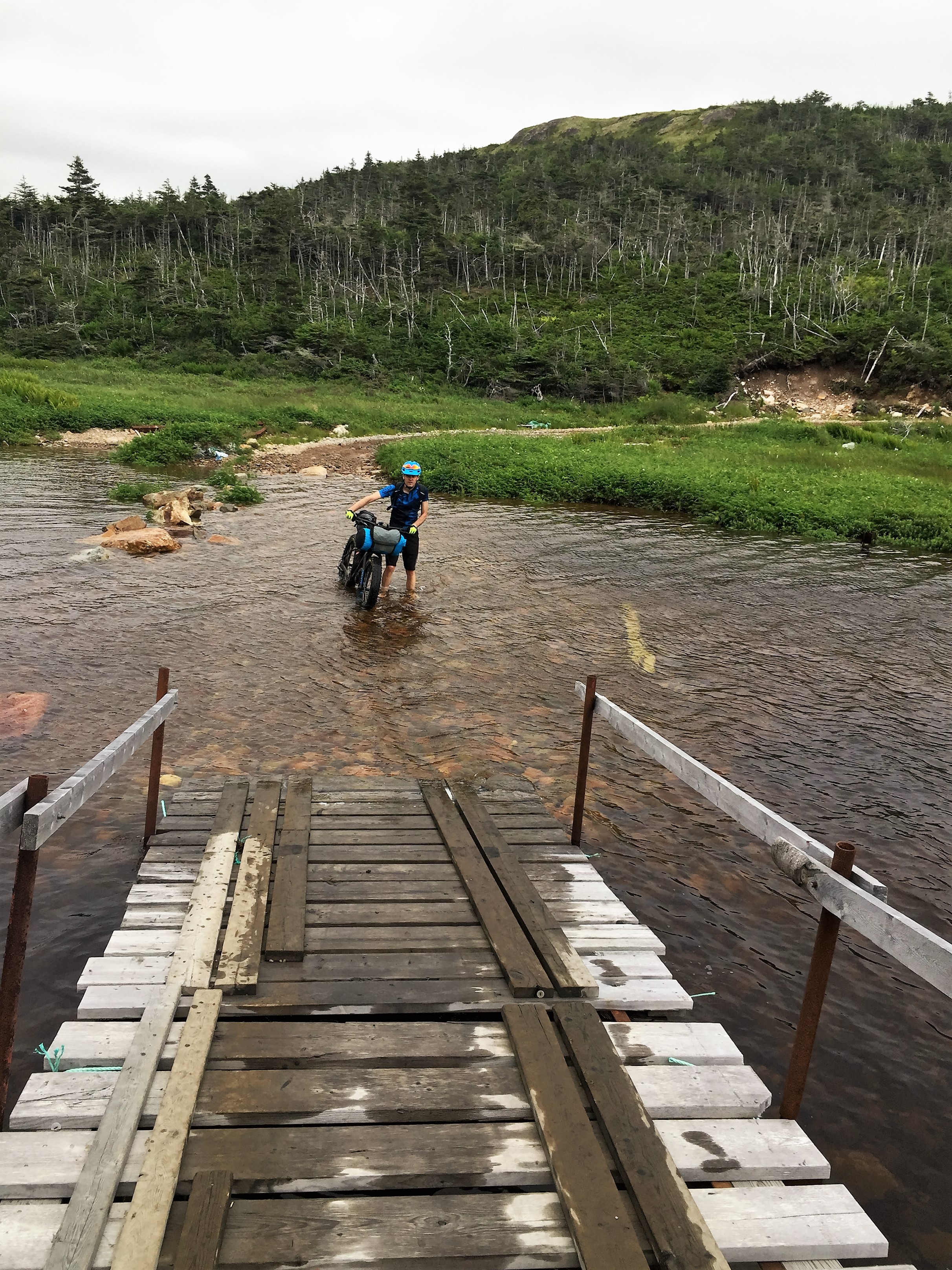
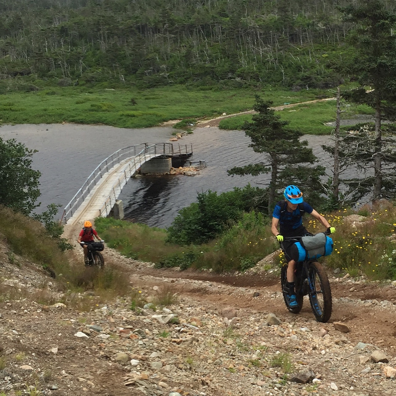
We made it as far as the bridge over the Main River, then turned around and wisely headed over to the Rocky Harbour area where a little less snow had been falling.

Glenburnie to Woody Point

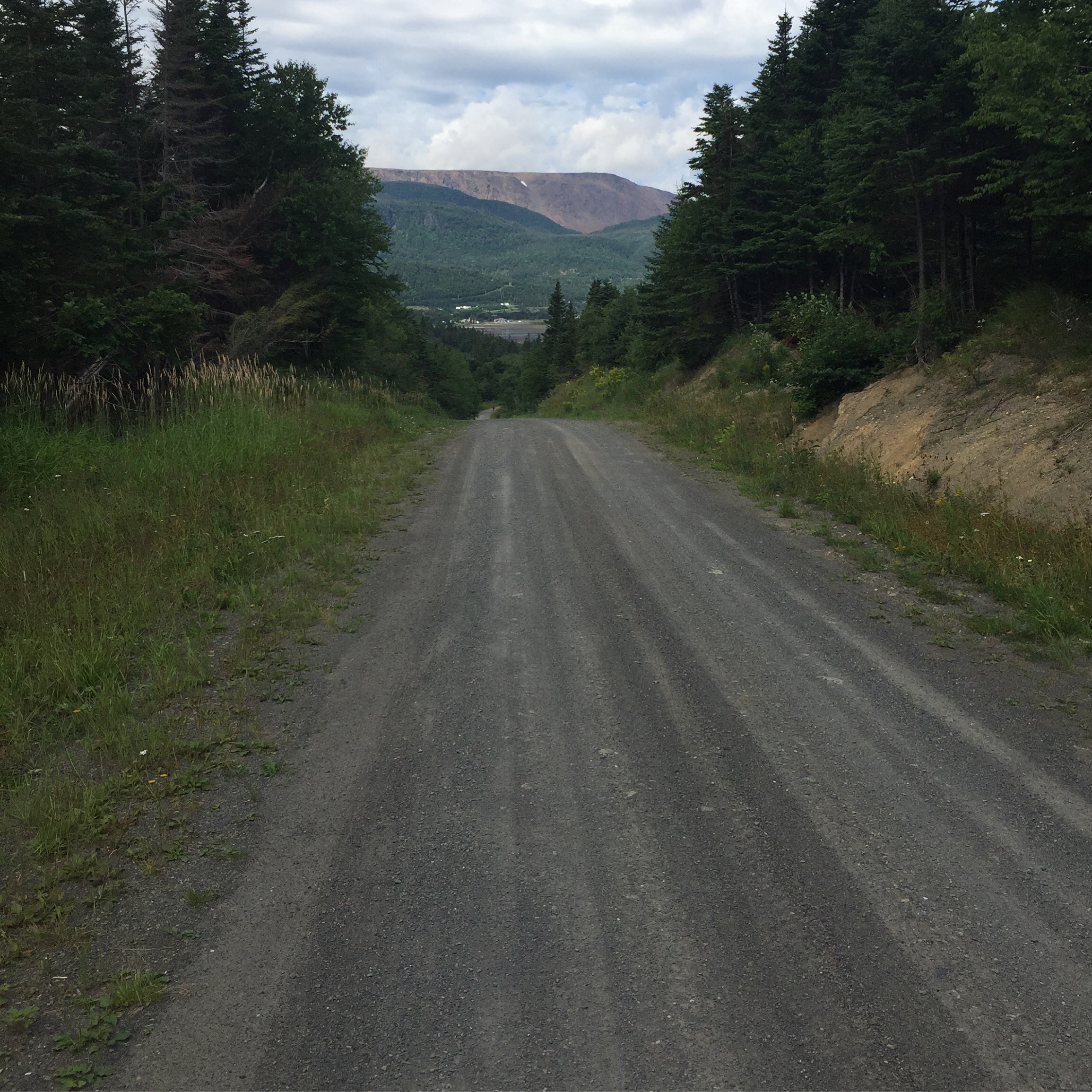
The snow continued to fall on day two so we decided to check out the groomed snowmobile trail from Glenburnie to Woody Point and back and were we ever pleased that we did.  An instant fatbike classic route was born!  The route is 30 km return and it goes up, it goes down and it twists and it turns; and to top it all off, the scenery is fantastic.

GlenB to Woody Pt

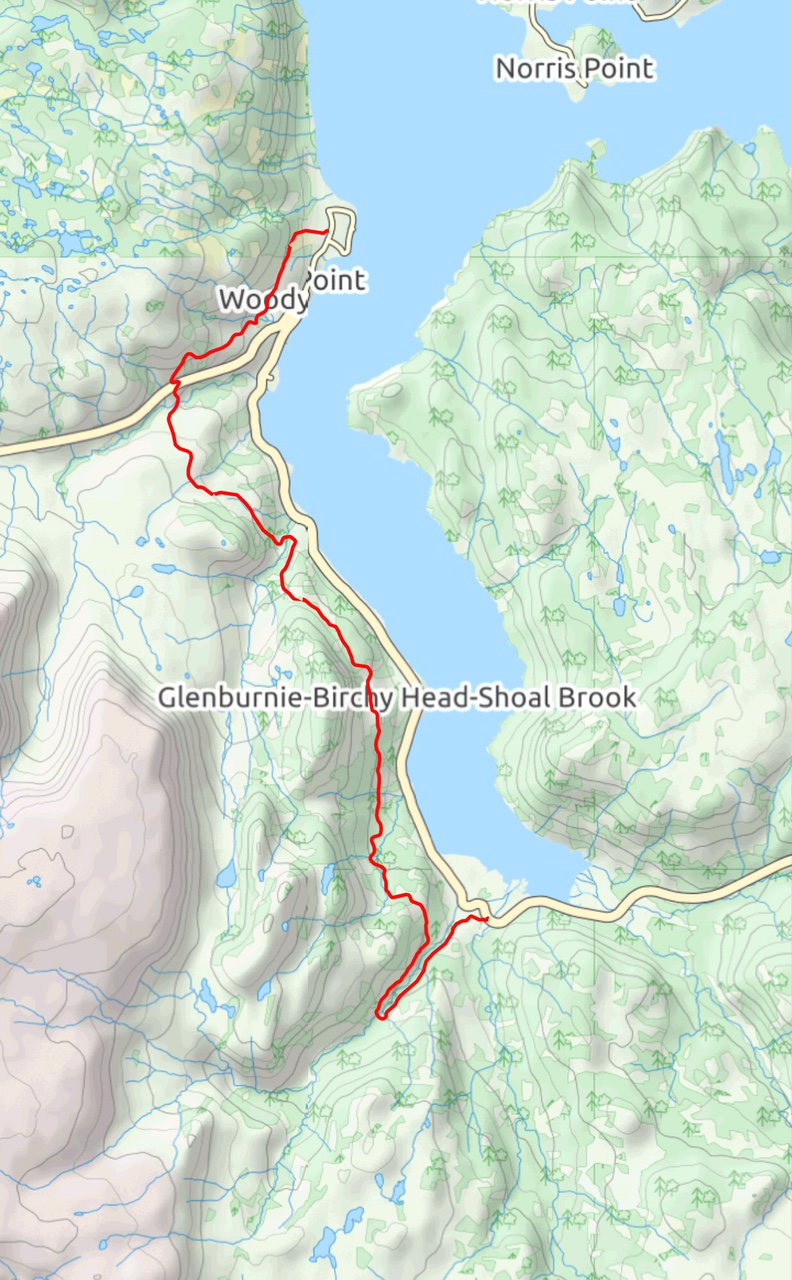
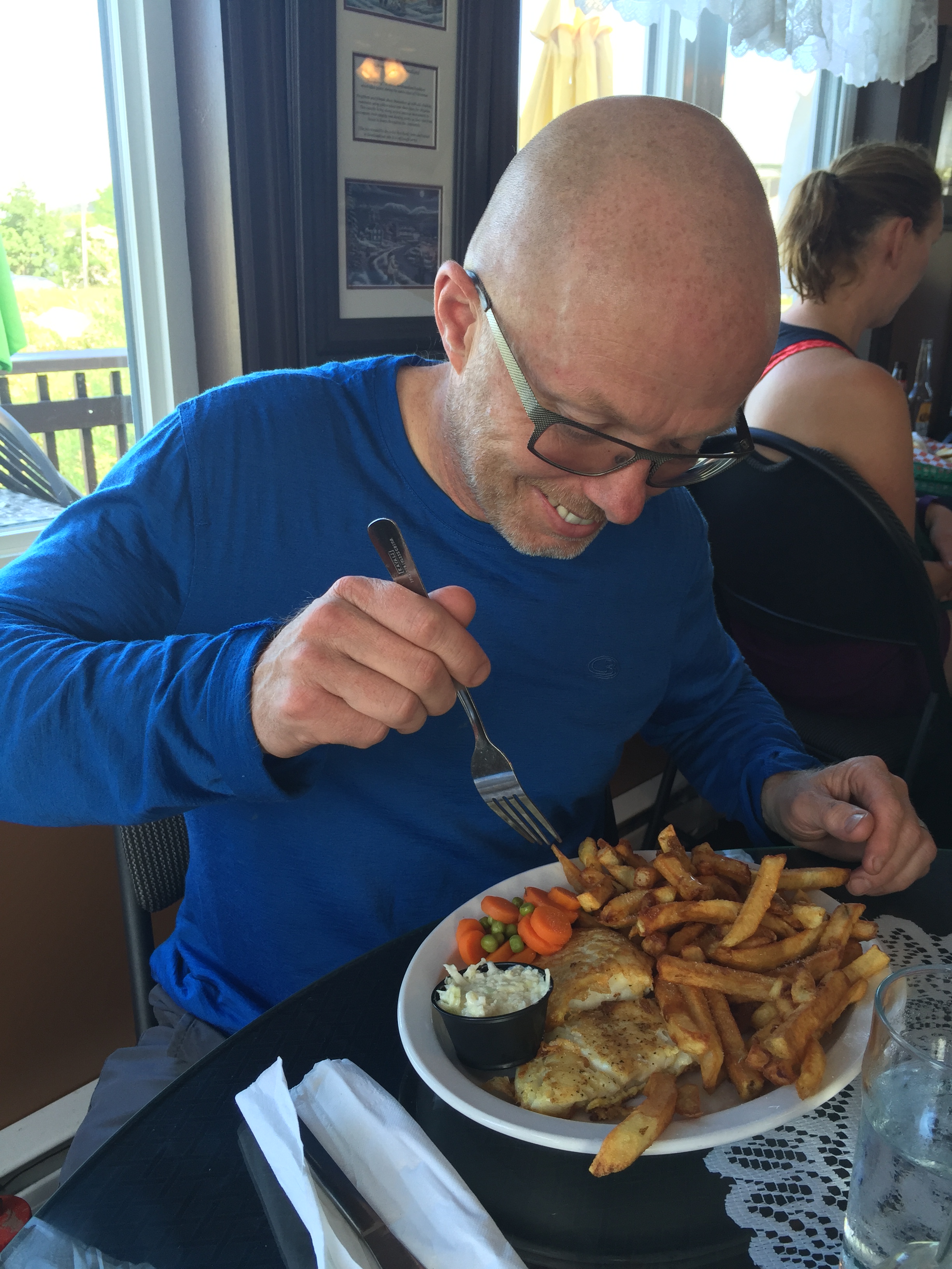
We started in Glenburnie and it took two hours to ride the 15 km to Woody Point, where we went into a shop and had a snack before the return ride.

Groomed

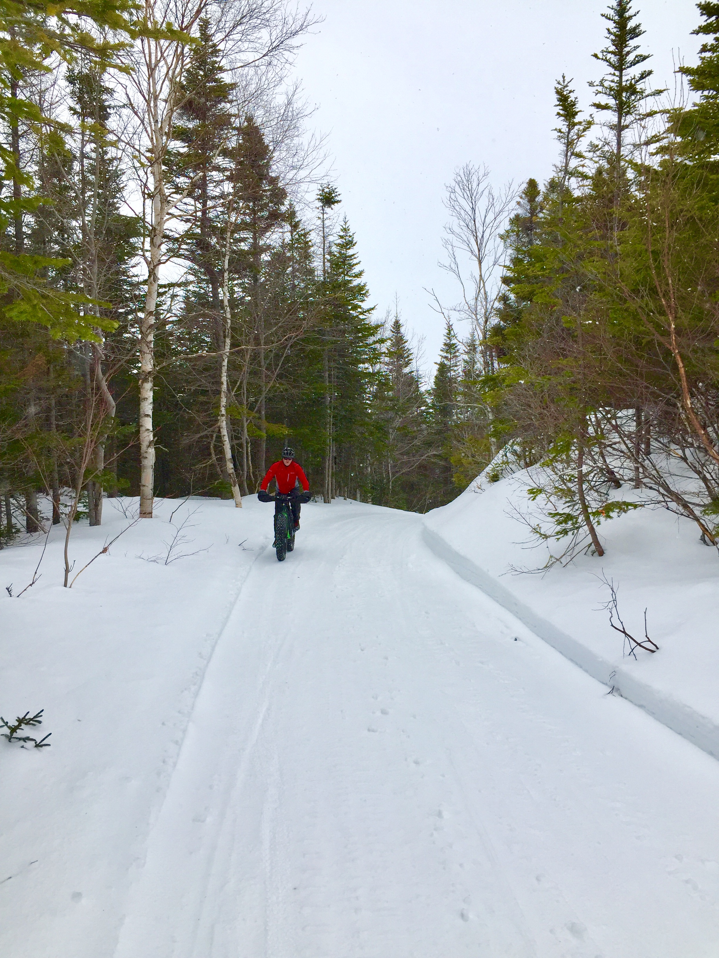
Riding groomed snow is such a treat.

Bridge

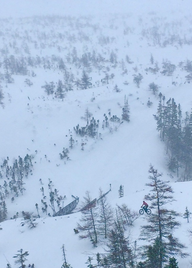
LOTS of elevation change on this route.
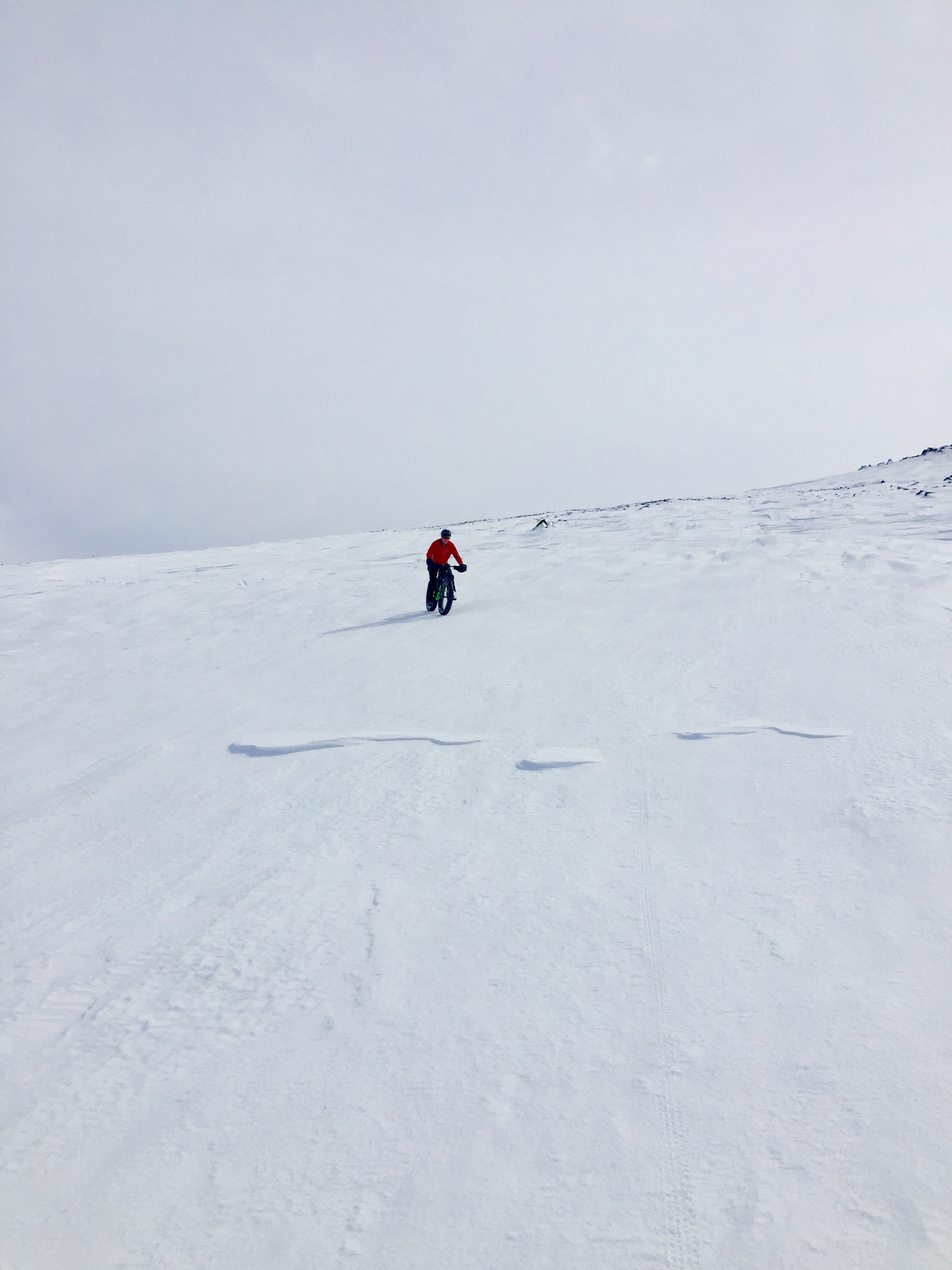
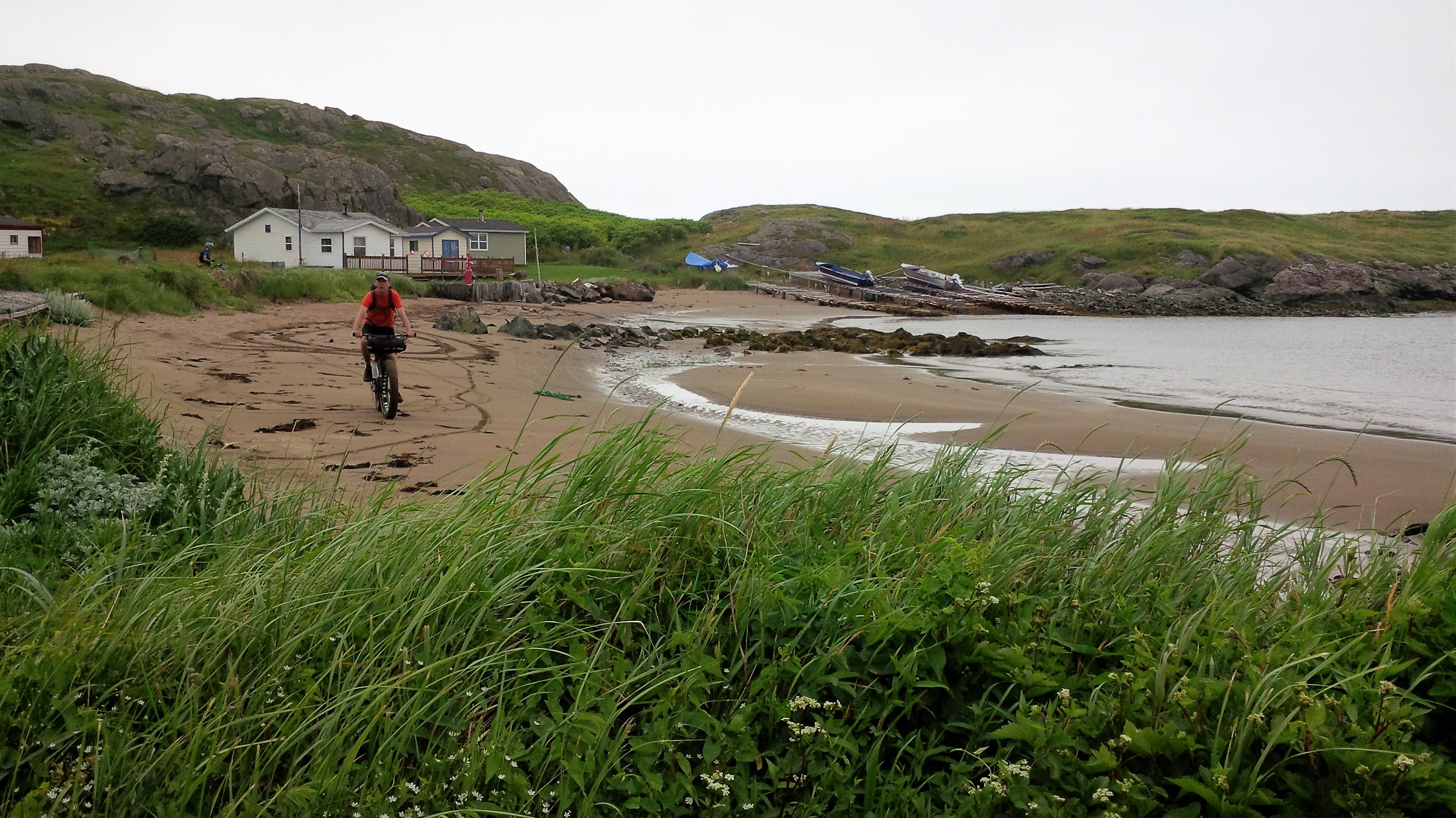
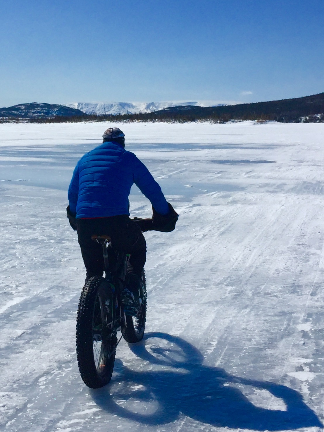
Sally’s Cove

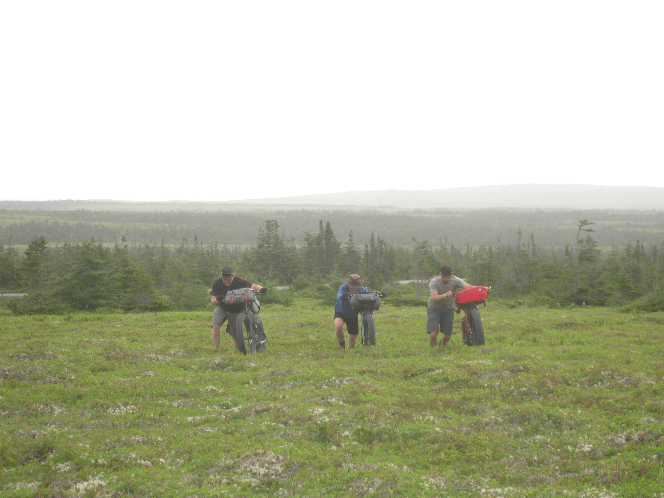
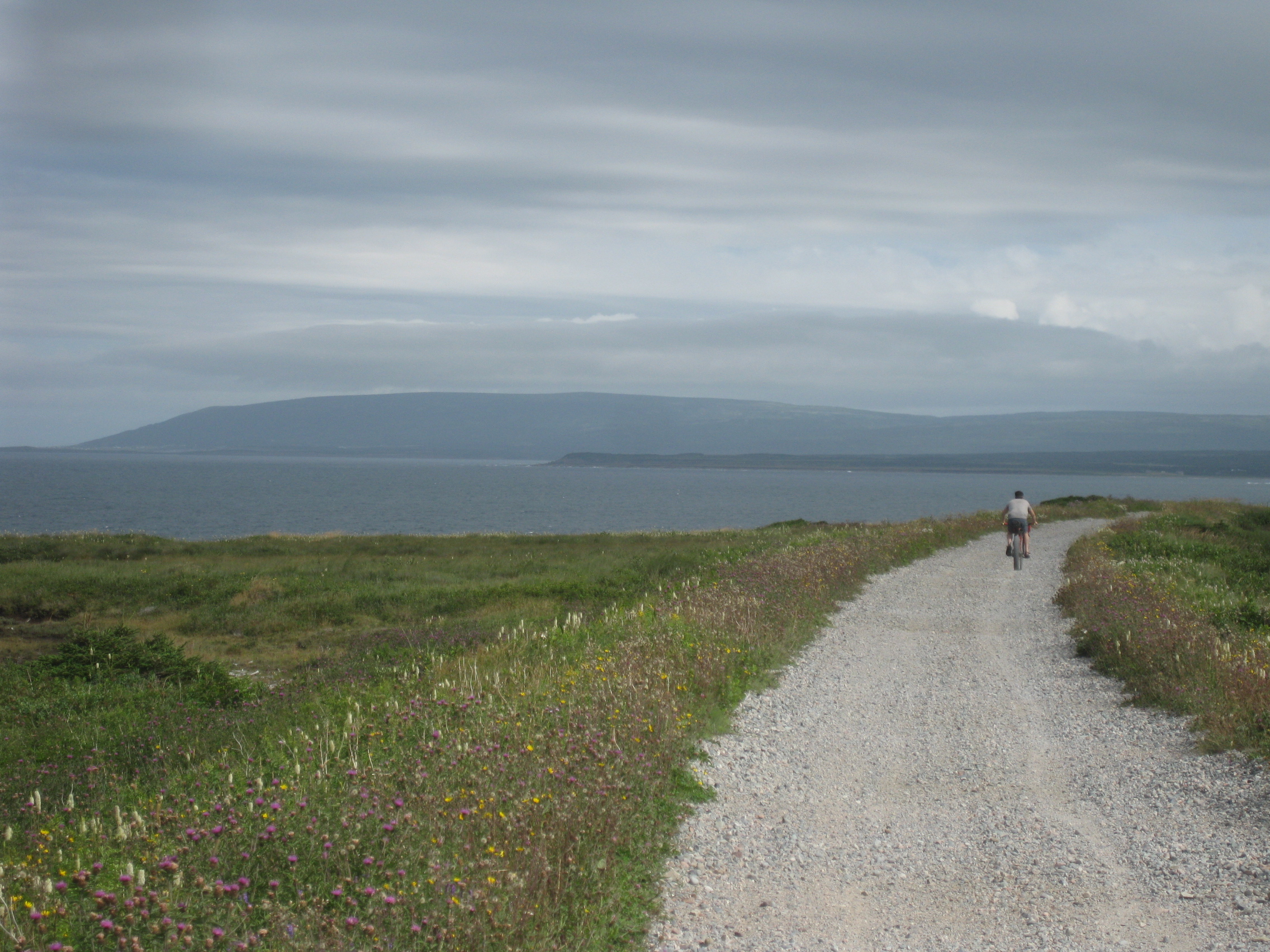
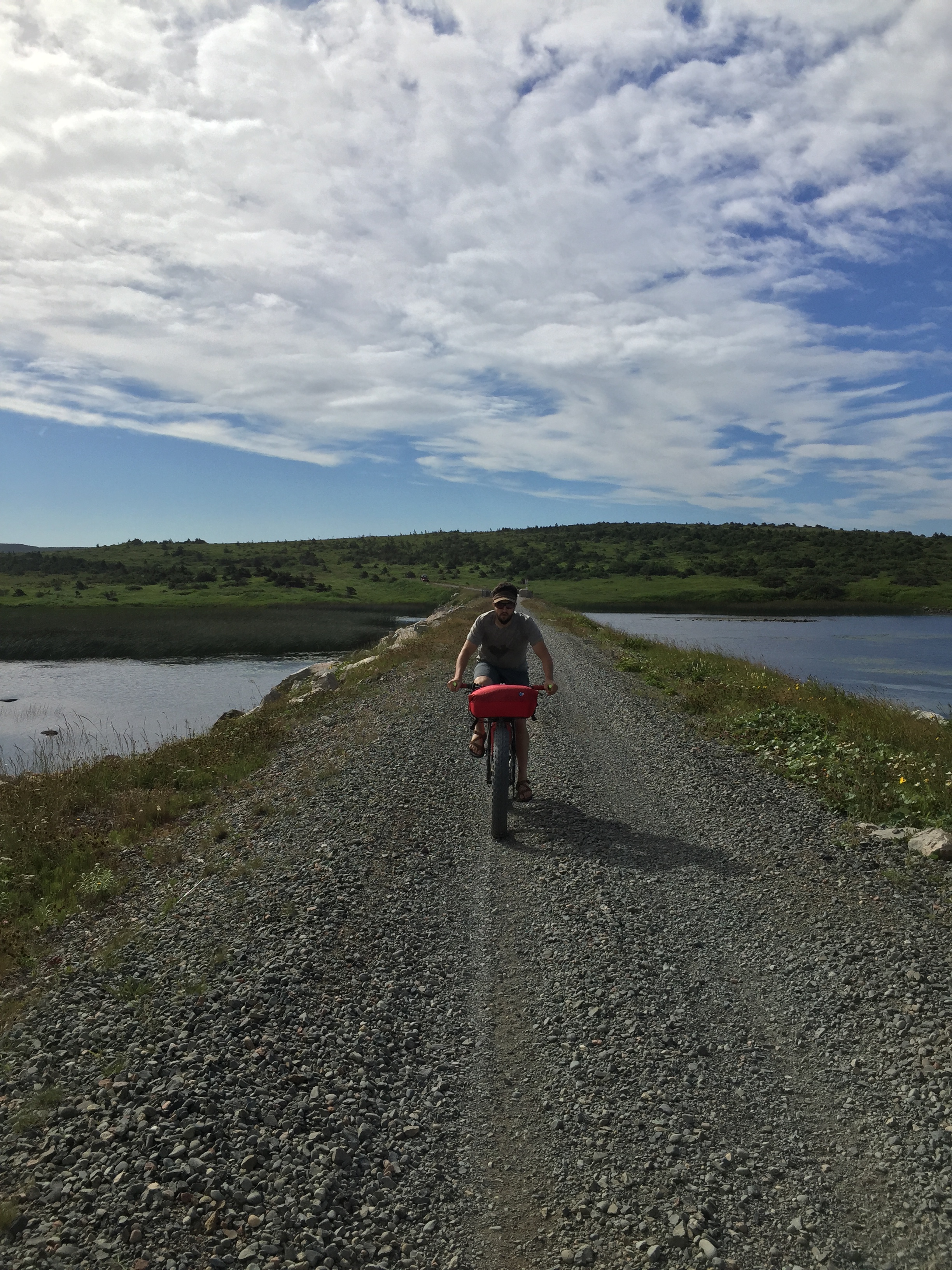
On Day 3 the snow finally stopped falling and the sun eventually came out.  We decided to try another new route near Sally’s Cove, which is on the coastal plains north of Rocky Harbour.  This area typically gets less snowfall and we were hoping to find a new route into Baker’s Brook Pond and then on to Rocky Harbour, but once again the recent snowfall (and the lack of snowmobile traffic early in the day) had us turning around after just 4 km.


Sallys Cove

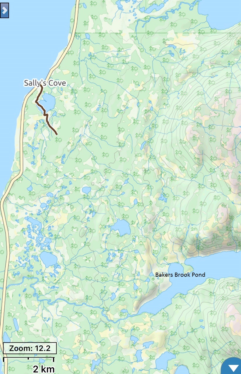
We had hoped to ride into Baker’s Brook Pond and on to Rocky Harbour, about 20 km one way.

Sallys Cove

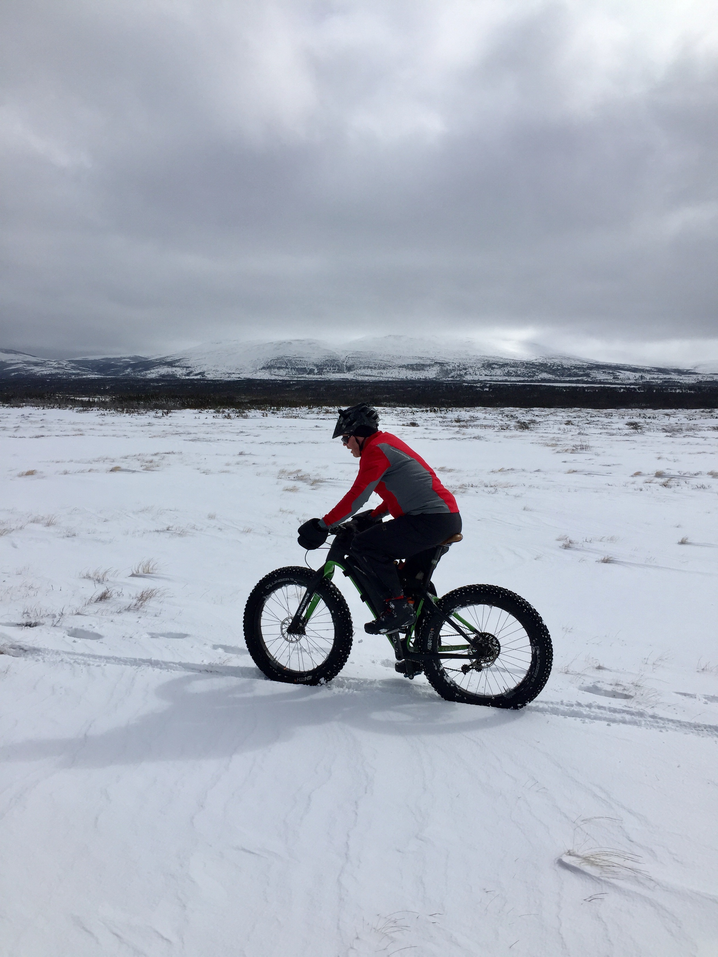
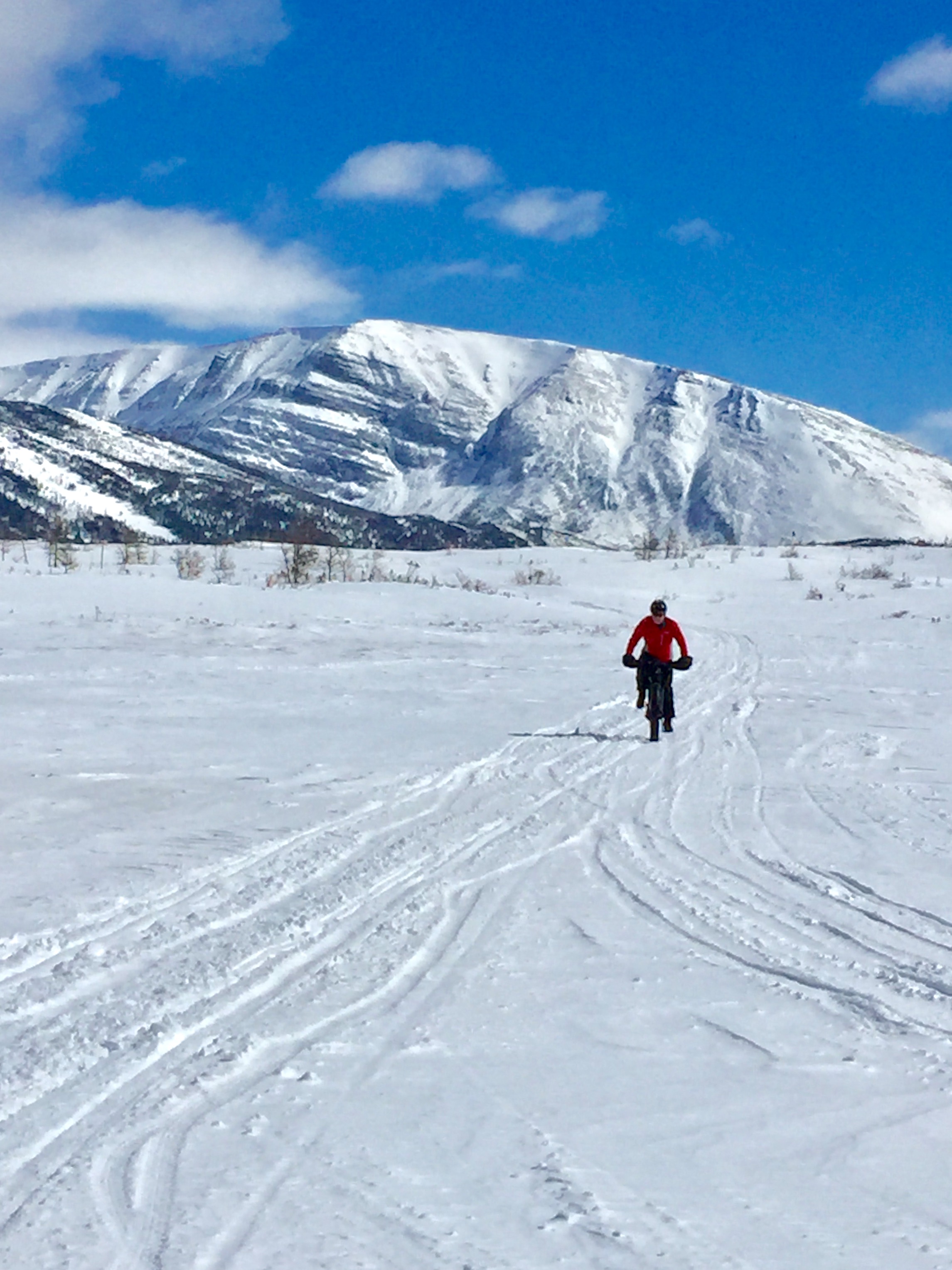
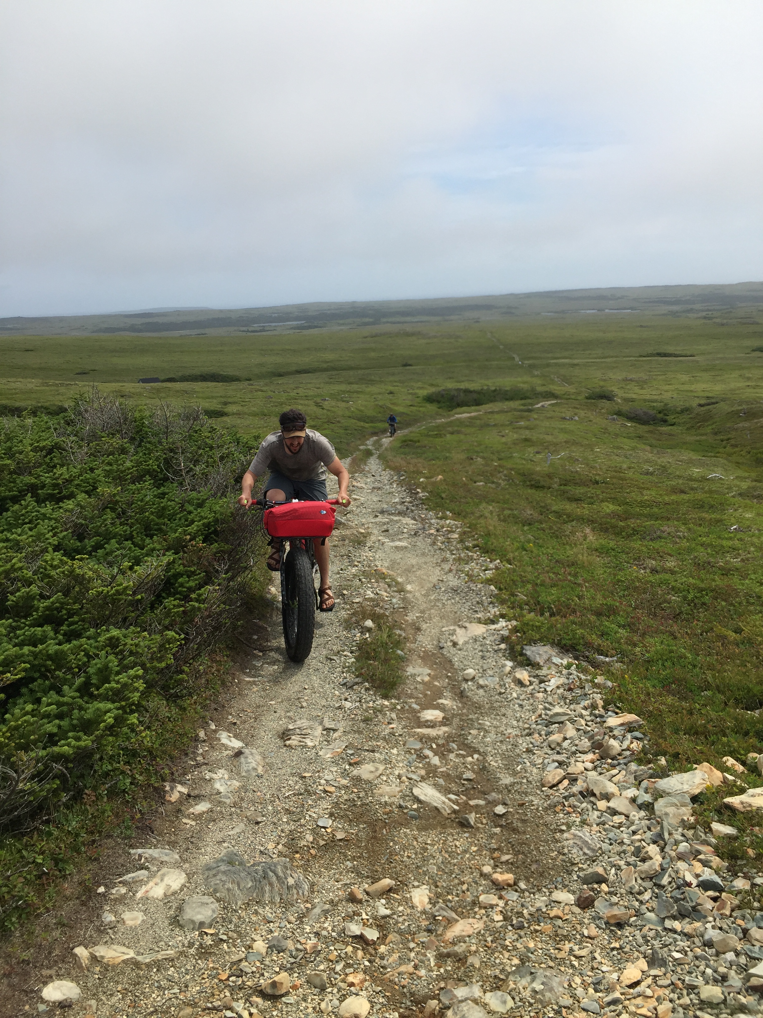
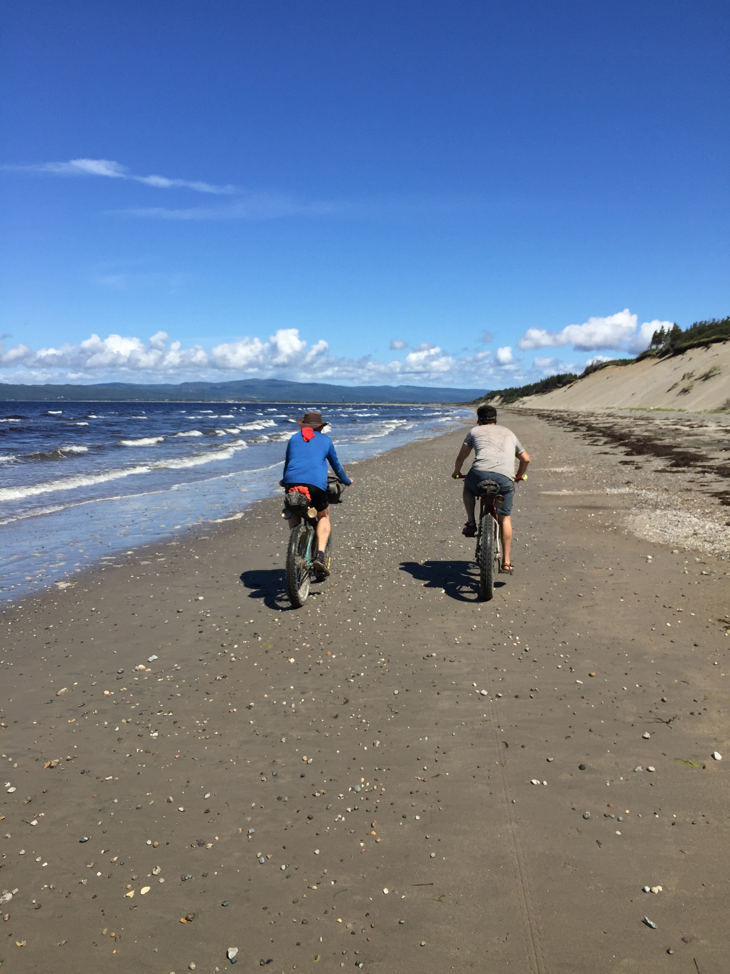
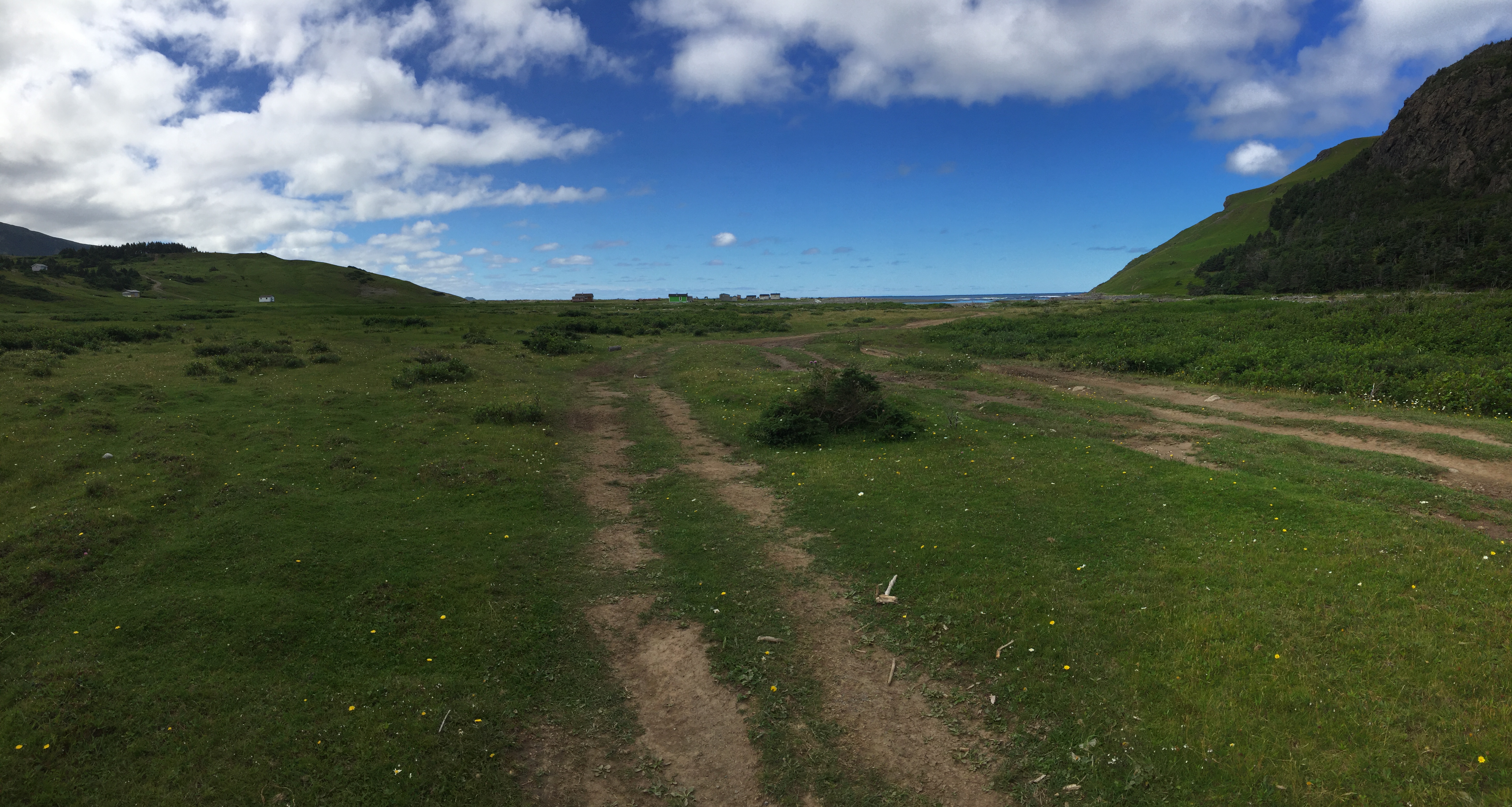
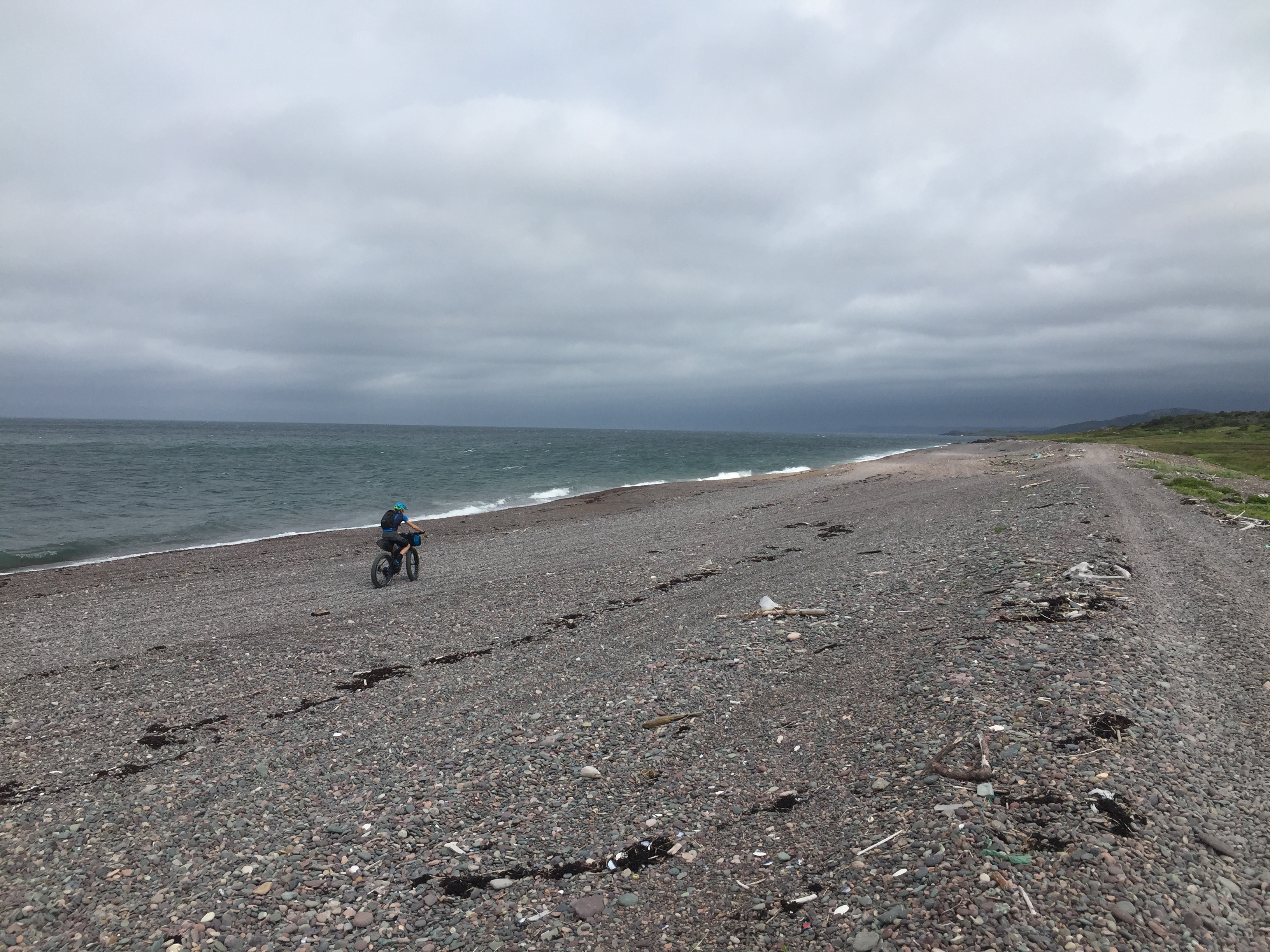
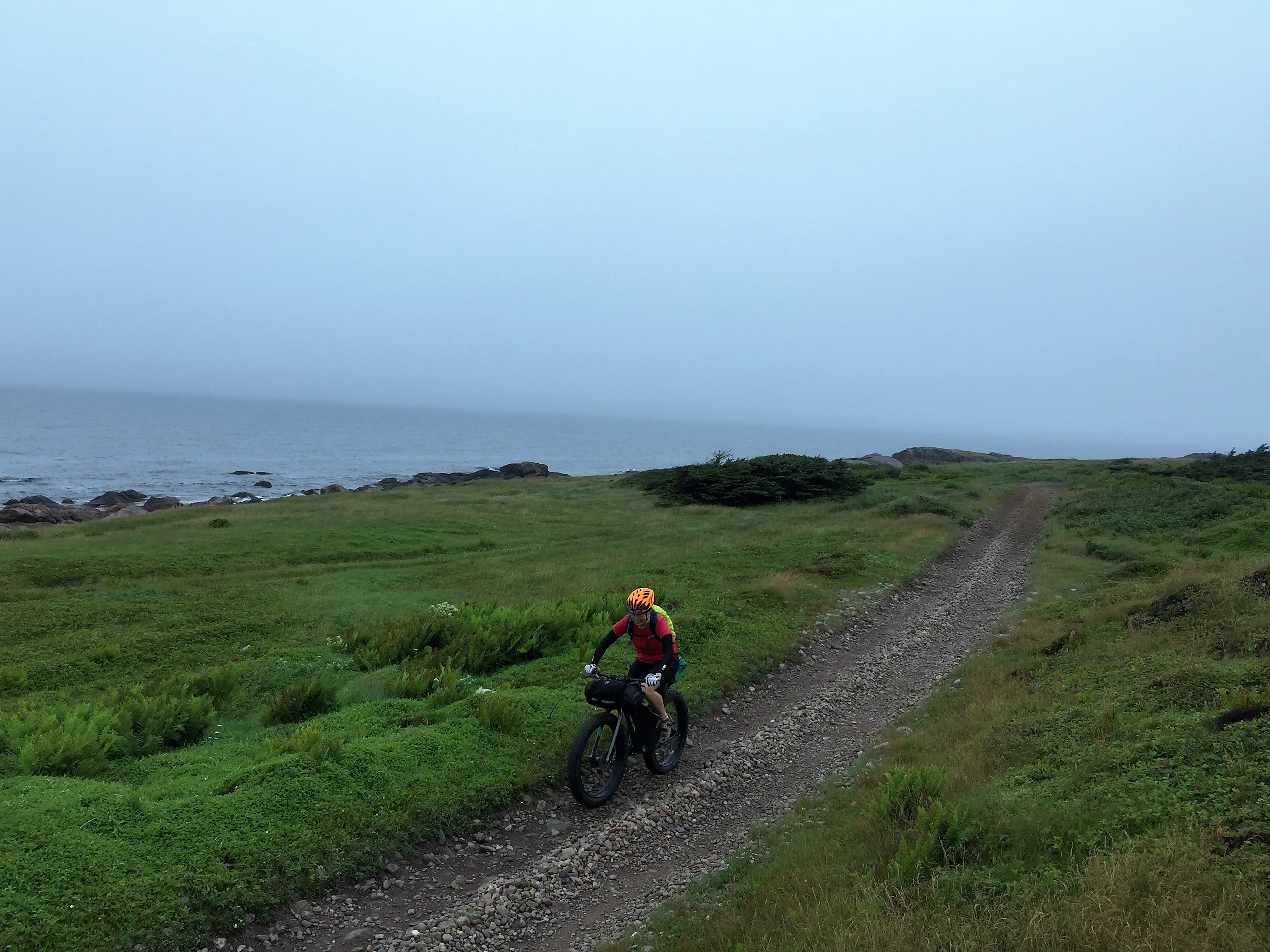
The area near Sally’s Cove is flat and windswept.
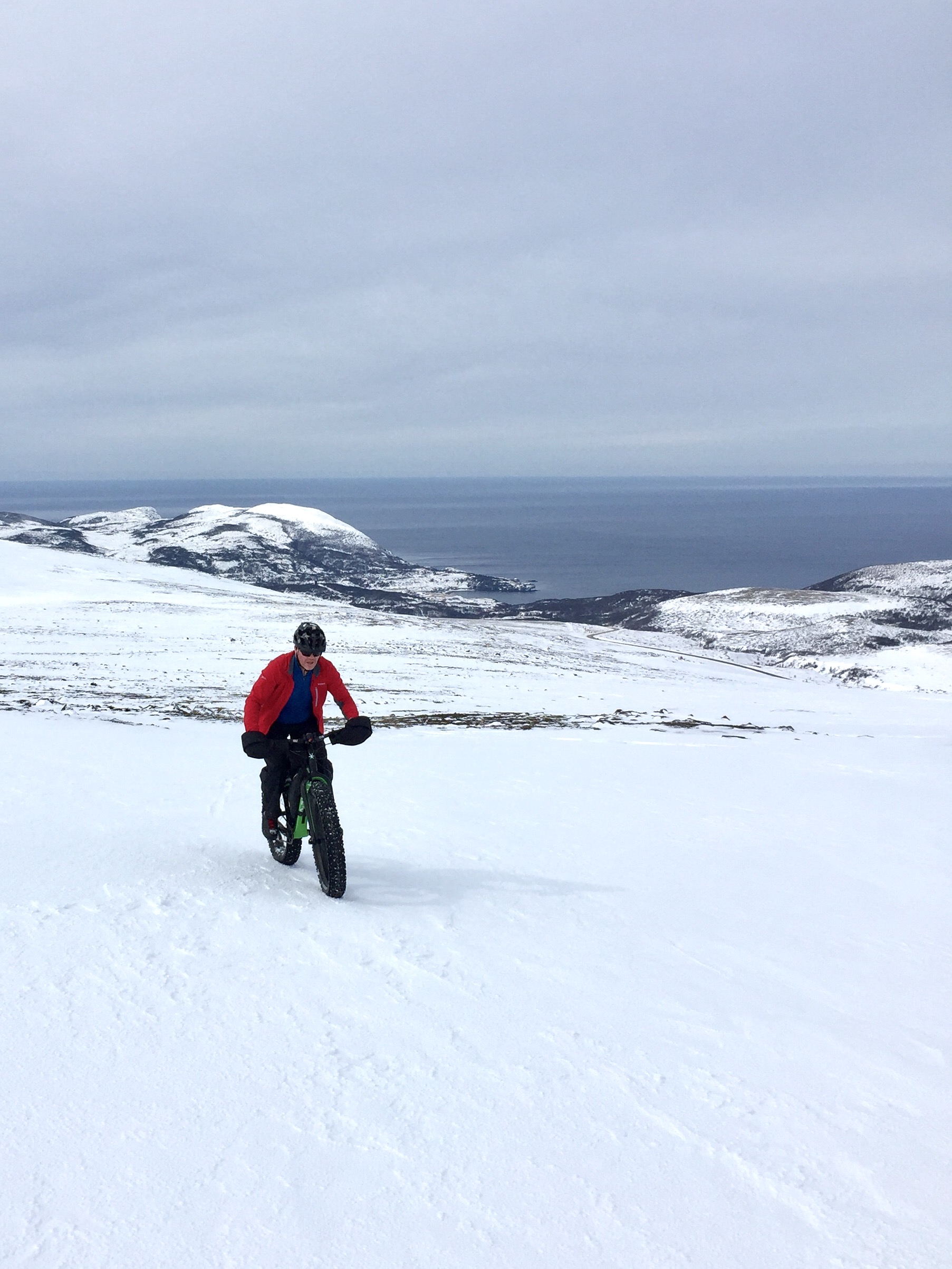
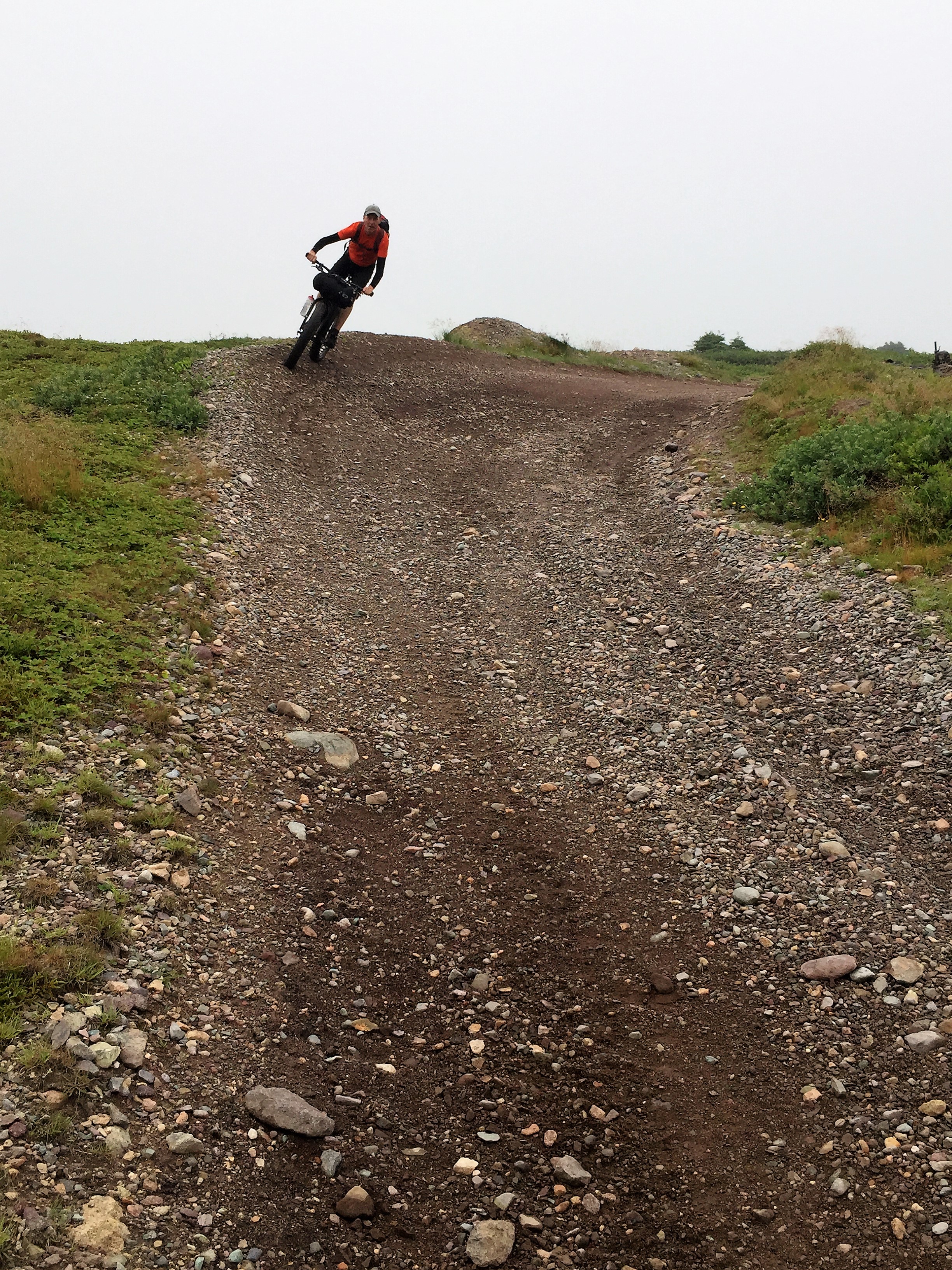
Rocky Harbour Loop

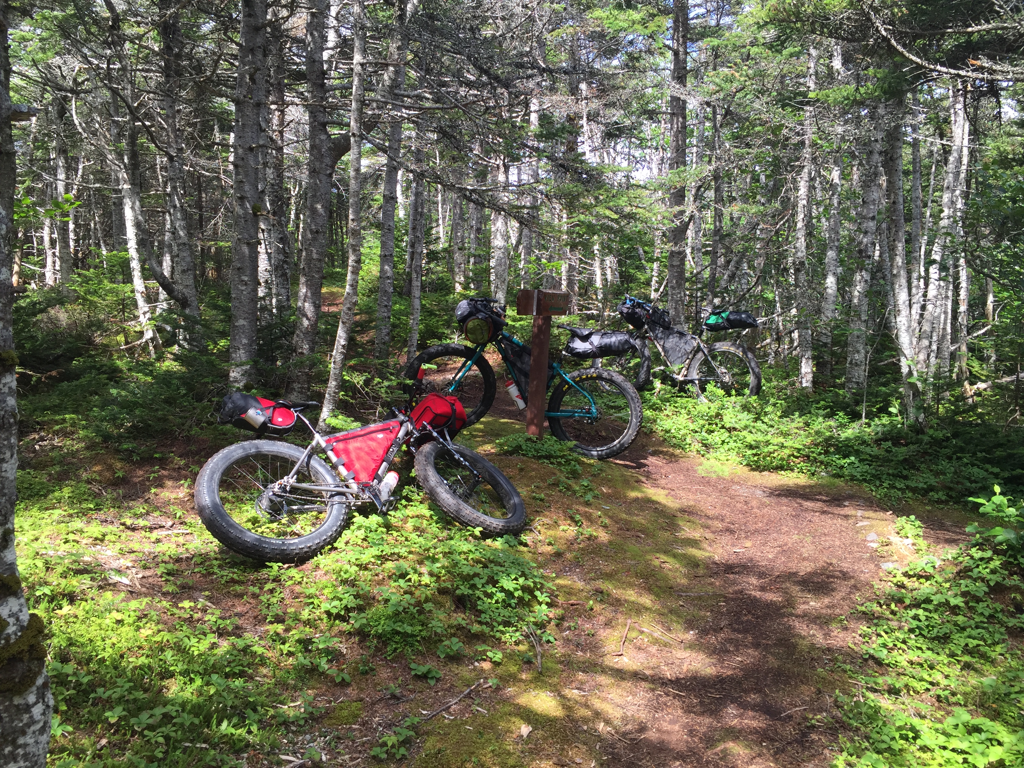
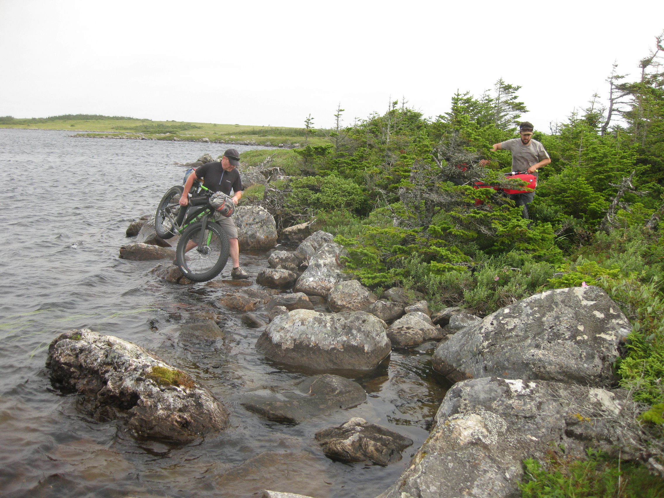
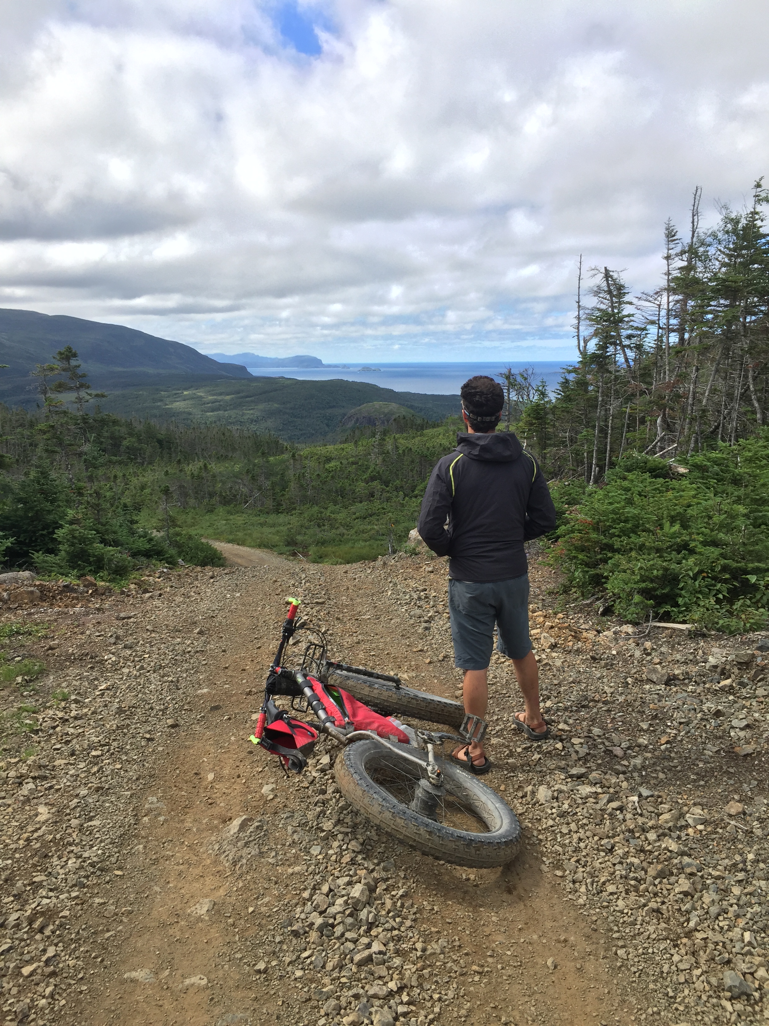
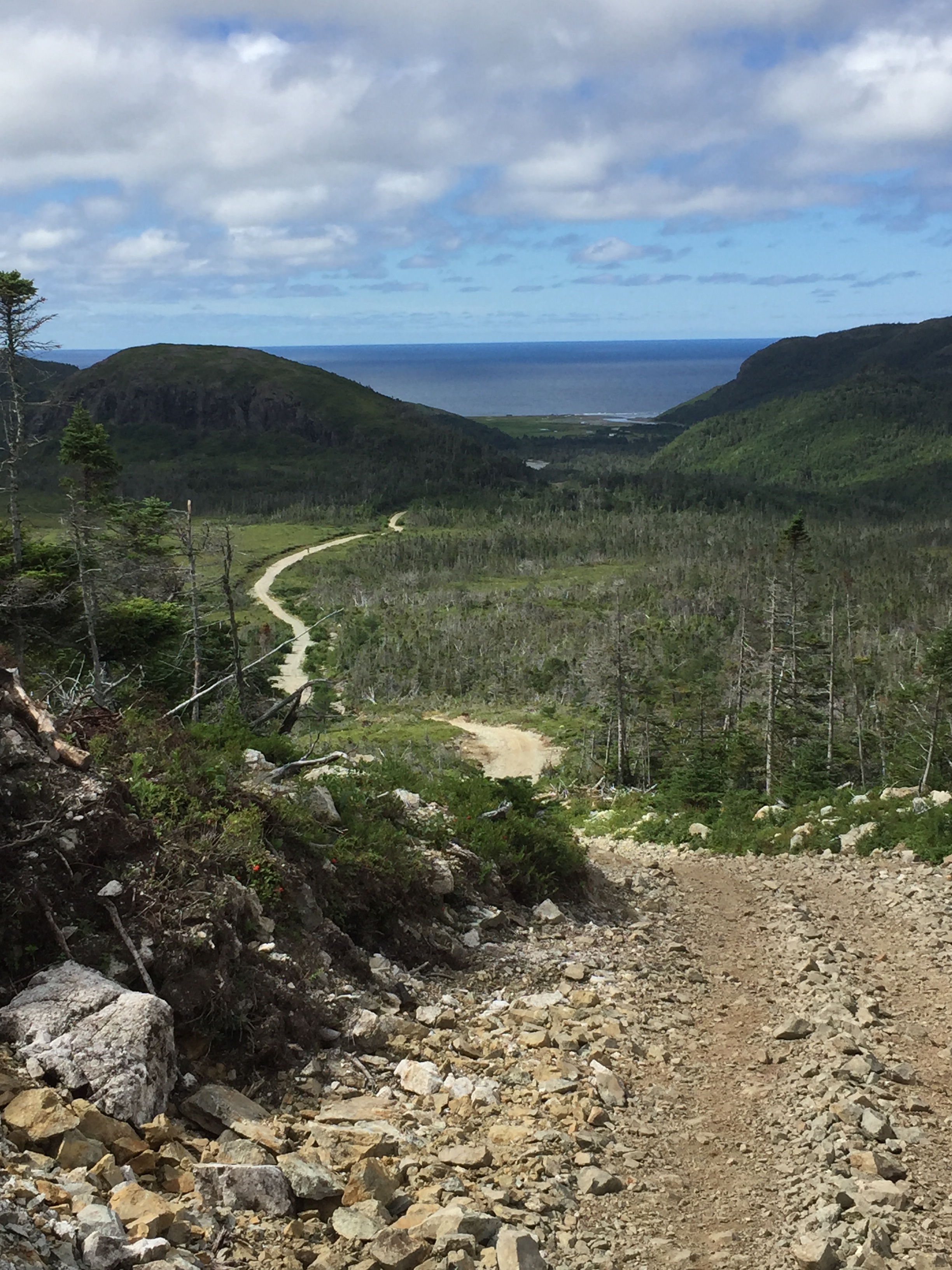
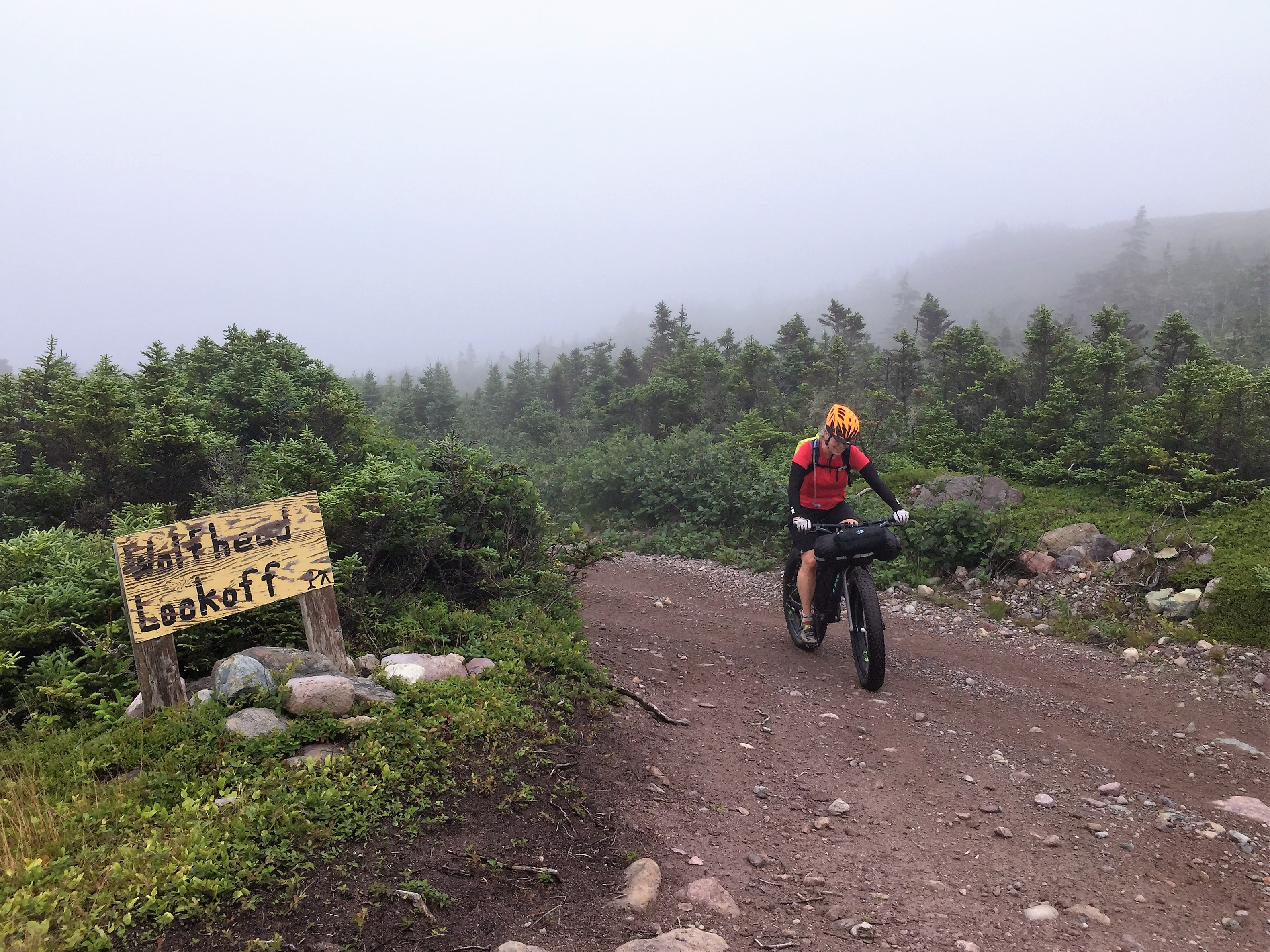
We left Sally’s Cove and headed back to Rocky Harbour, to ride a loop we did two years ago.  This loop has a lot going for it:  you can start right in Rocky Harbour, it gets a lot of snowmobile traffic so any fresh snow will be tracked, the scenery is out of this world, and you can use it to get into Ten Mile Pond and Baker’s Brook Pond.

RH Loop

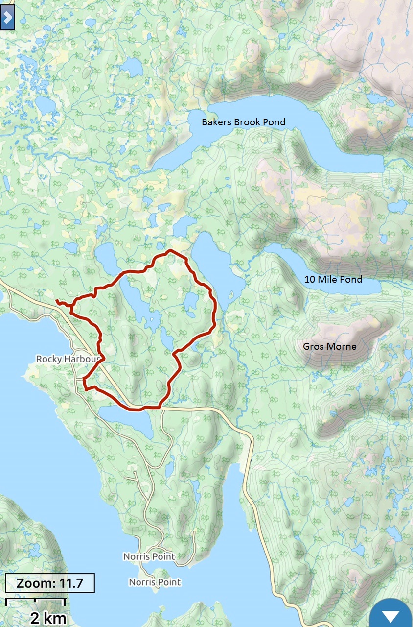
We started at the hockey arena; the loop as shown here is 20 km.

Start Rocky Hbr

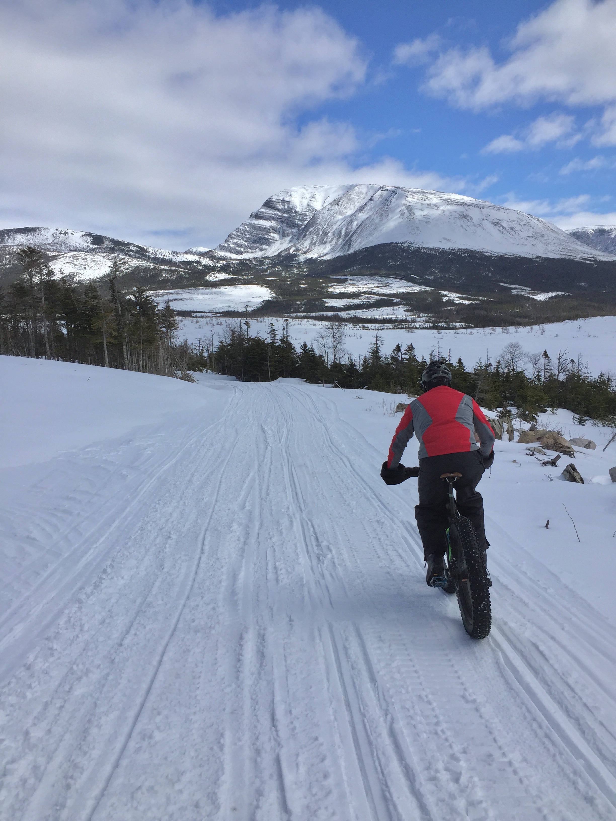
Near the start of this loop.

GM Background

Gros Morne in the background.

Bridge and GM

Rocky Hbr

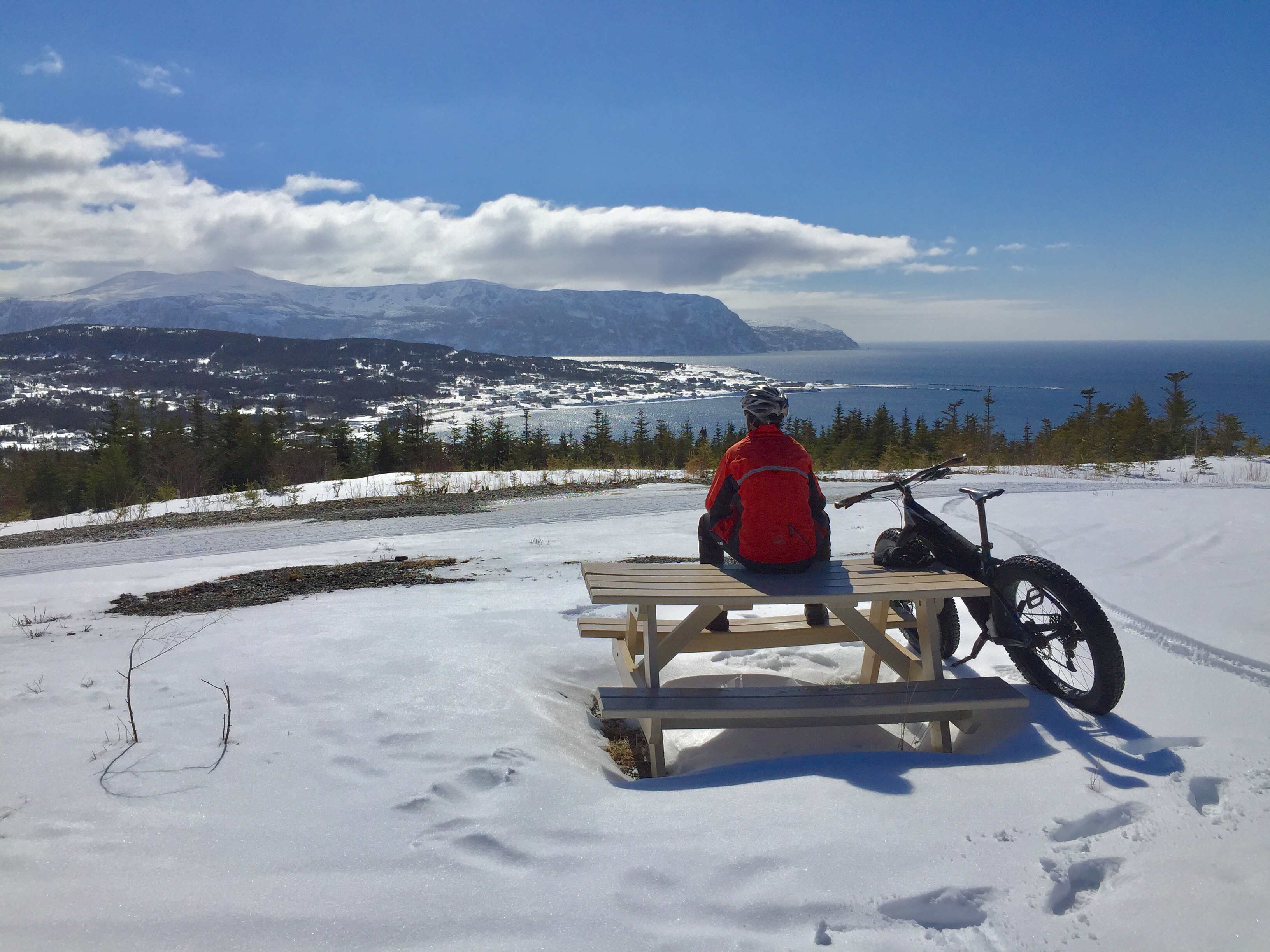
Looking down on Rocky Harbour.
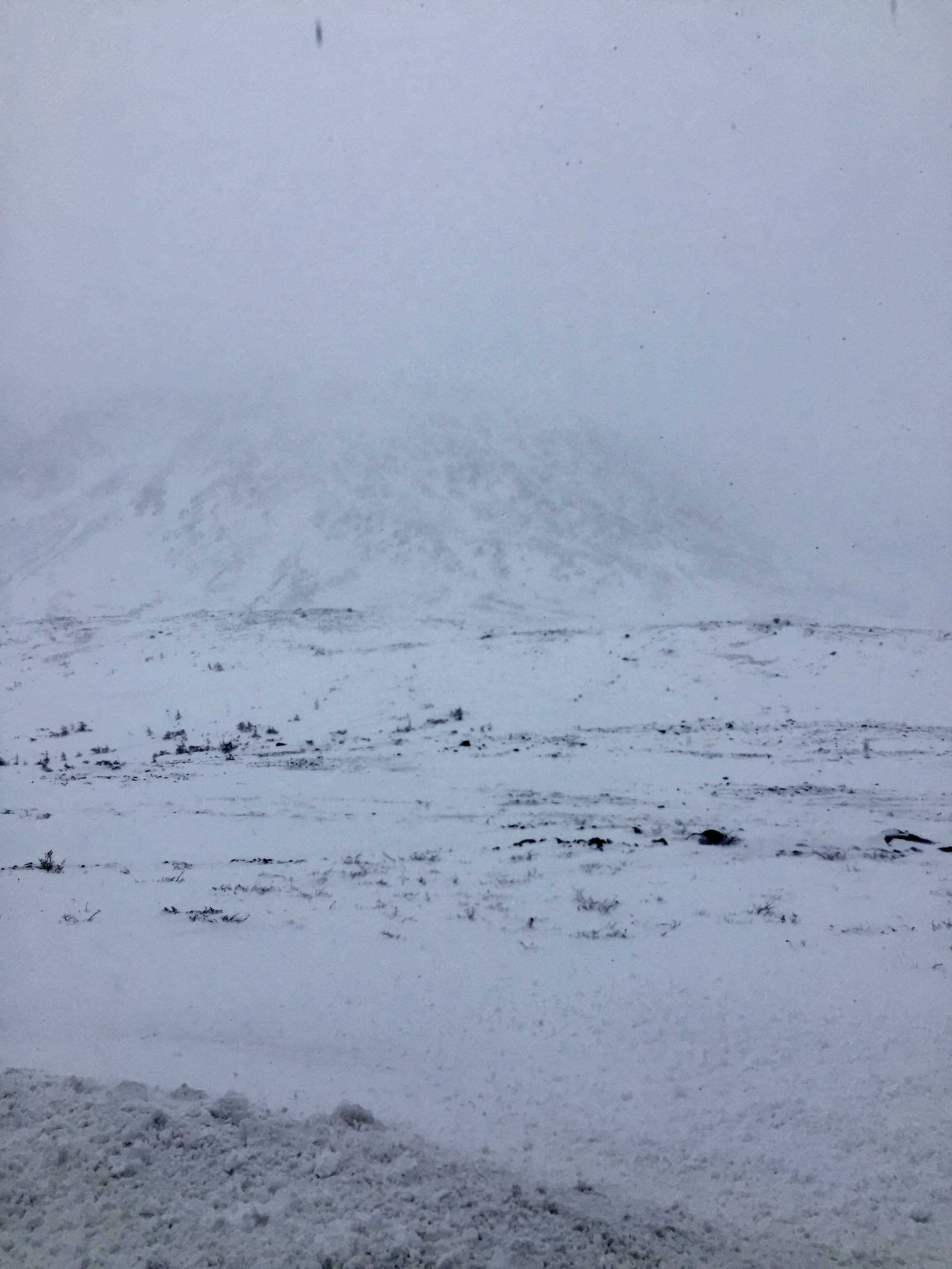
The Tablelands

Both of us had been on top of The Tablelands before in winter, but on those occasions we were on snowshoes.  This area is very windswept and what snow stays on top often turns into boilerplate and we thought it would make for good riding.

There are a couple of options for getting to the top and what we did on this attempt was to park at the trail head for the Green Gardens hike as this gained us lots of elevation by driving.  As we discovered, there was still lots of elevation to climb to get to the top.

Tablelands

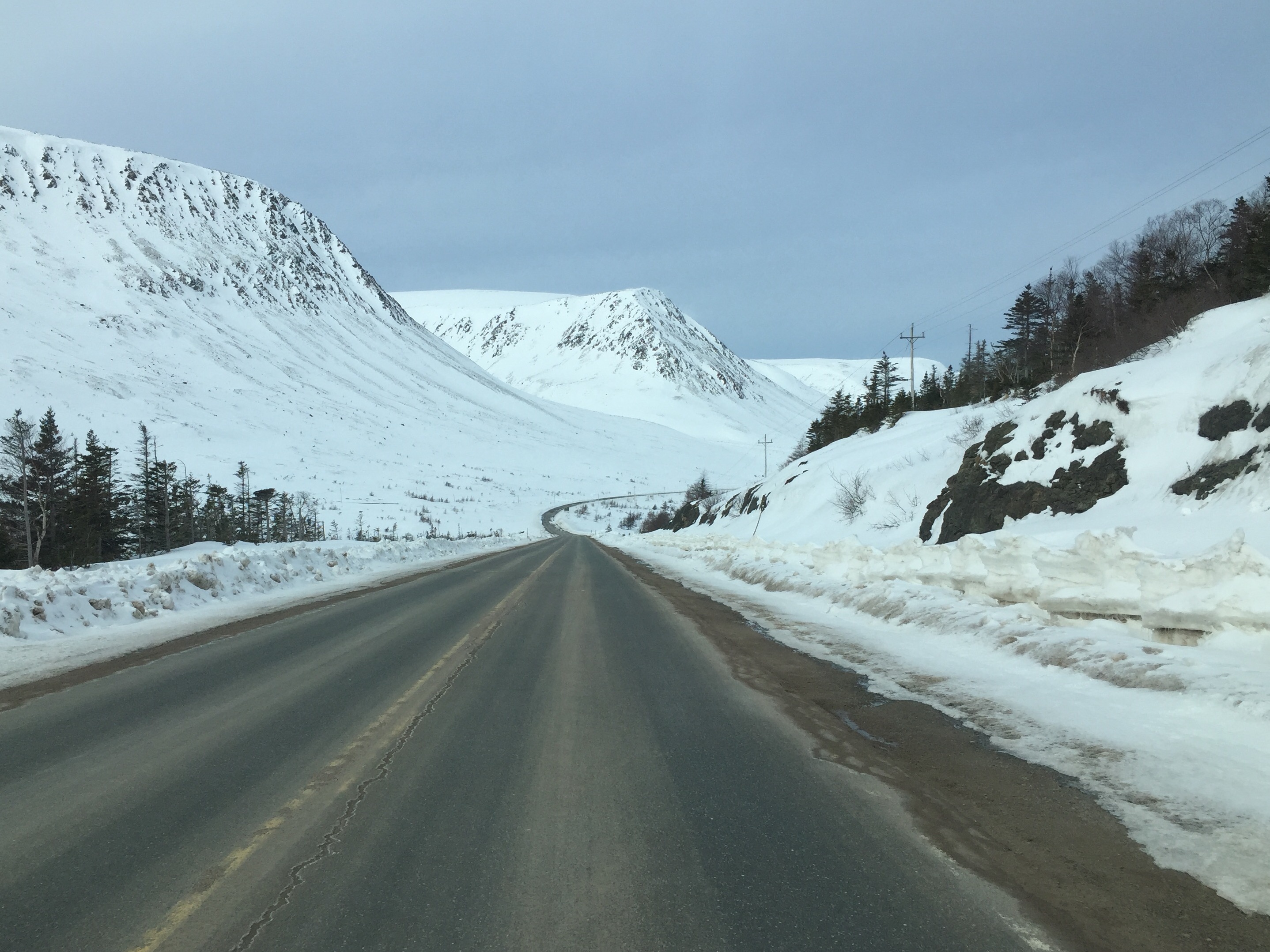
The view of The Tablelands from the road.

Tablelands

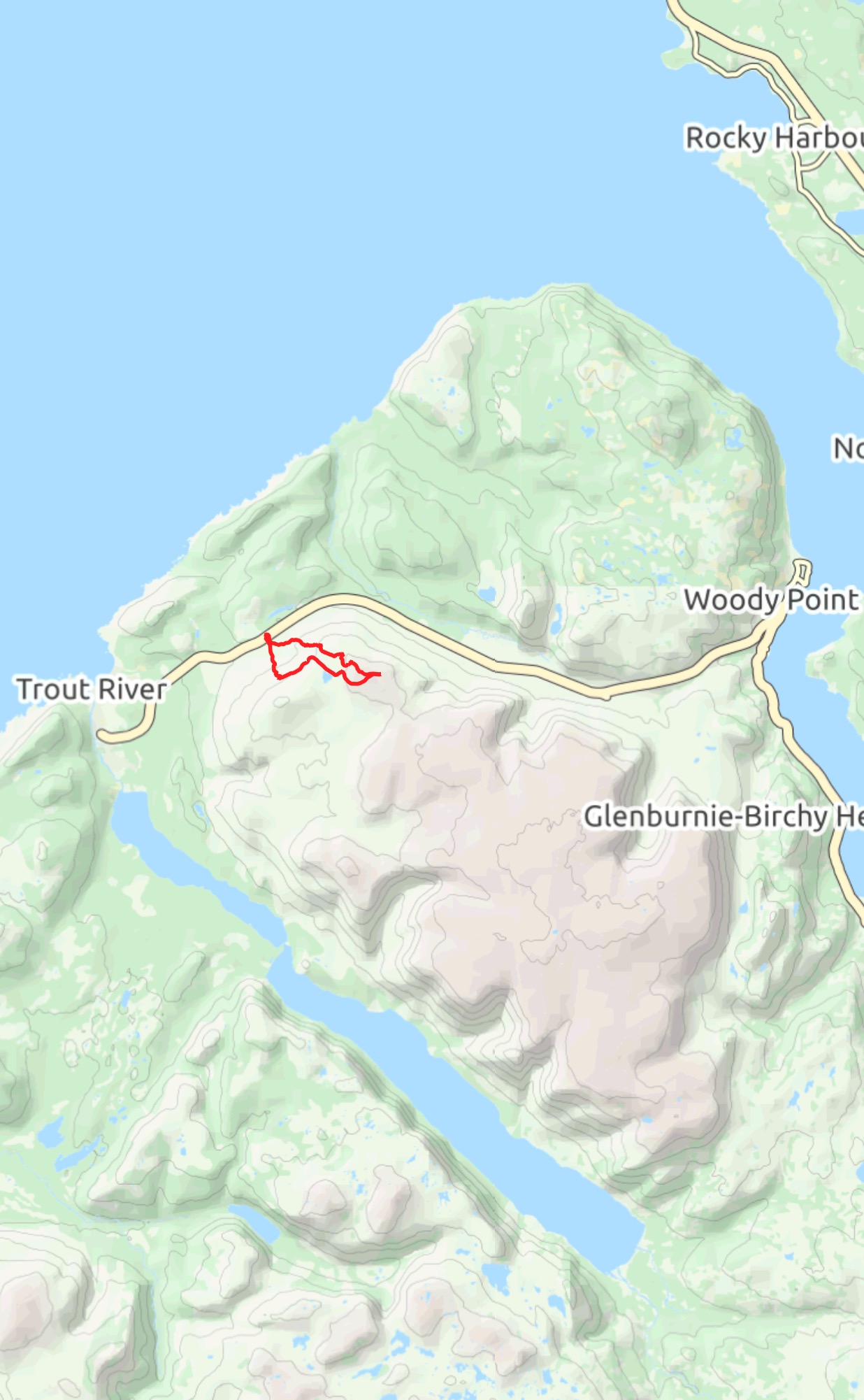
This shows you the route we took; the loop was 8 km.

Up Tablelands

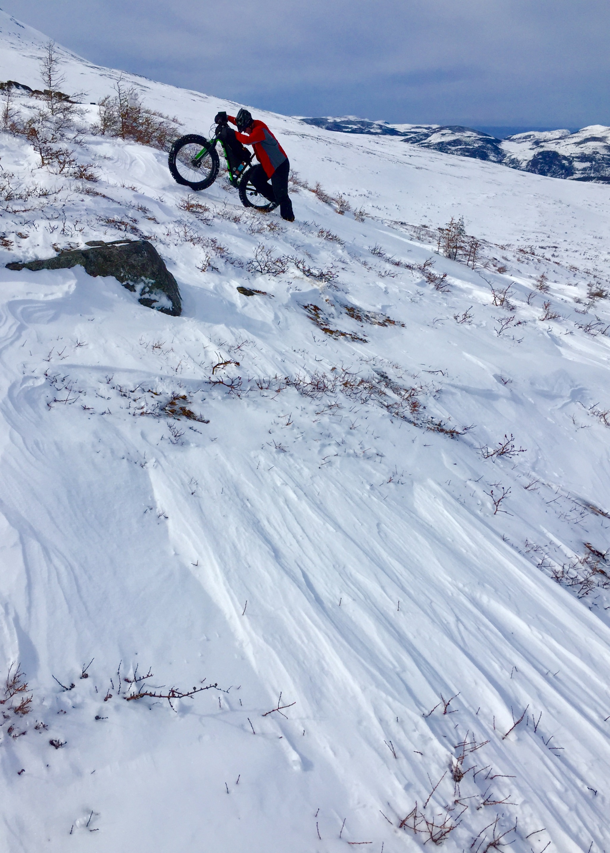
Fresh snow and steep inclines had us pushing most of the way up, but given the right snow conditions we believe a fair bit of it could be ridden.

Top Tablelands

Up on top, with Trout River in the background.  We were able to ride in some spots but we failed to find the boilerplate we were hoping for.

Down Tablelands

Coming back down was a scream and had me laughing hysterically!


what i did last summer

I spent 3 weeks last summer riding with Scott (of Porcelain Rocket fame) and Tony (with his own kind of fame) all around the island.  Our route consisted of riding the Irish Loop Off Road (clockwise) to Whitbourne, then caught the bus to Port-aux-Basques where we rode the Trailway back to St. John’s, with a side trip to Gros Morne thrown in for good measure.  We covered about 1700 km in total.

I’ve written about the Irish Loop Off Road here and here, and covered The Trailway here, so I won’t write much about them again.  What was new to me was an off road route from Hughes Brook (near Corner Brook) to Glenburnie, which is in the heart of Gros Morne. This route was about 90 km long, had lots of loooong climbs and screaming descents, and is just a wonderful way to get into the Gros Morne area as compared to riding the highway. What was also a first for me was a day trip to Chimney Cove, which begins near Trout River campground. As you will see in the pictures below, Chimney Cove is a special place.

img_3098

The Irish Loop Off Road incorporates parts of the East Coast Trail between Witless Bay and LaManche.

img_3099

There’s noting easy about lugging a loaded bike up and down the stairs near LaManche bridge.

img_3103

We ate a lot of pan-fried cod on this trip.

img_1472

Darren joined us on day 2 of the trip.  From Cape Broyle to Trepassey much of the route follows the old railway tracks.

img_1460

Kingman’s Cove wharf.


img_1464

img_1479

We spent our second night at Chance Cove.

img_3111

The beach at Chance Cove.

img_1492

Day 4 begins with a hike-a-bike section to pick up a dirt road that runs to Portugal Cove South.

img_1496

Scott goes through the tuckamore while Darren goes around it.

img_1495

Momma moose and a calf.


img_3117

On the “road” to Portugal Cove South.

img_1509

img_1517

Camp above St. Vincent’s.

img_3145

Waiting for the bus to take us to Port-aux-Basques.

img_1524

Port-aux-Basques.

img_1527

On the Trailway, shortly after leaving Port-aux-Basques.

img_3151

img_3156

Yes, Tony and I qualify – unfortunately…

img_3158

We rode about 100 km the first day on The Trailway and camped here, at St. Fintans River.

img_3159

Another 20 km or so past St. Fintans bridge there is a snowmobile warm-up hut.

img_3163

Fischells River.

img_3181

Getting off the Trailway and riding the beach near St. George’s.

img_3175

img_3184

Karl’s – a great place to stop in Stephenville Crossing.

img_3186

Get yourself a couple of Scramblers and a Pepsi while at Karl’s; you’ll thank me.  Or not.

img_3187

Camping on the shore of Georges Lake.

img_3188

In Corner Brook.

cb-to-glenburnie

This is the route from Hughes Brook to Glenburnie.  It is on logging roads and was a great ride.

img_3197

Entering Glenburnie.

img_3198

On the road to Chimney Cove.

img_3201

img_3205

The outskirts of Chimney Cove.

img_3214img_3226img_3221img_3224img_3229

img_3237

Leaving Chimney Cove.

img_3241

img_3247

Celebrating a great day at the Rusty Jigger in Trout River.

img_3273

Camp in the Gaff Topsails.

img_3277

The high point of the former Newfoundland Railway.

img_3281

Gravel pit camping near Bishop’s Falls.

img_3284

Vegetarian Surprise – “I thought it said cheddar and broccoli!”

img_3290

img_3295

Crossing the Terra Nova River.

img_3304

Bonfires and beers.

img_3309

Between Clarenville and Goobies.

img_3312

L-R: a Tumbleweed Prospector, a Moots FrosTi, and a Surly Pugsley.

img_3317

As seen on the isthmus to the Avalon Peninsula. 

img_3323

End of the trip.

me-tony-scott

return to point rosie

Darren and I rode to Point Rosie in 2014; later that year Guy and Ruth did it as well.

img_2992

I got back to Point Rosie this year, this time with a couple of good friends, John and Nancy.  This was the first bikepacking trip for each of them. Here we are at Frenchman’s Cove Provincial Park.  We drove down the day before and spent the night here.  The park staff let us leave our vehicle in the day use parking area while we did our ride.  This also had the added bonus of access to showers before the trip home!

img_2995

John crossing the bridge at the trailhead.

img_2997

img_3002

The town of Garnish in the background.

img_3009

One of the bridges was a little bit shorter than the last time I was was here.  No problem – we just took off our shoes and waded across.

img_3074

There are lots of short, steep hills to contend with.

img_3015

Point Rosie, where we spent the night.  Just before entering the community there is a small stream where you can get water.

img_3075

Noodling around on the beach.

img_3027

On the way home.

img_3049img_3069

irish loop off road (ILOR)

ilor

400 km, 5 days and 4 nights. Green triangles indicate where I camped.

Over the May 24th long weekend I tackled the route I’ve been calling “Irish Loop Off Road” or ILOR.  If anybody has a better name let me know (Paul C?).  Amy, Paul and I first tackled this route two years ago, that time riding it in a counter-clockwise direction and learning what worked and what didn’t.  This iteration of the route is much better.

This ride has it all:  80% of it is on dirt, the majority of the paved sections are on quiet roads; single track, dirt roads, ATV tracks, 2 hike-a-bike sections; great vistas; wildlife (I saw caribou, moose and a snowy owl on this trip); resupply is easy; free camping; water is easily available.

I now have GPX files for this route – if you would like them just drop me an email:  theslowbiker at gmail.com.

gros morne fatbike 2016

Easter fell during a prime time for fatbiking Gros Morne this year, so Darren and I made plans to go there for the week.  We had a short, preliminary exploration of the park last year and knew that there was lots more we wanted to ride.  We weren’t disappointed…

Our Good Friday feast. At the junction of the Trans-Canada highway and Route 420 is White Bay Convenience. The food is fantastic - we had supper, breakfast and lunch there.

Our Good Friday feast. At the junction of the Trans-Canada highway and Route 420 is White Bay Convenience. The food is fantastic – we had supper, breakfast and lunch there.


Western Brook Pond

Day 1


Here's the route we took. (Darren McD image)

Here’s the route we took. Taylor’s Brook Road begins on Route 420. Drive in 3 kilometers and you will find Taylor’s Brook Accommodations. Ask for Terry – he will set you up with a place to park for a small fee (we paid $15 for 3 days, two nights). He will also have LOADS of knowledge about trail conditions. Pick his brain. (Darren McD image)

Here's the route with elevation. (Darren McD image)

Here’s the route with elevation.
(Darren McD image)

Darren and I at the start.

Darren and I at the start.

Looking west, on Taylors Brook Road.

Looking west, on Taylors Brook Road. The first 24 km are groomed. At Km 24 our route took a left off the groomed stuff and our real work began.

PR take 2


This is the view looking west. That is Matty's Pond in the left of the picture. The arrow shows the cove we camped in.

This is the view looking west. That is Matty’s Pond in the left of the picture, where we made camp.

On Matty's Pond.

On Matty’s Pond.

Stats from our first day.

Stats from our first day. We began at 10 AM and stopped at 5 PM. Elevation gained, fully packed bikes and loose trail for the final 16 km kept average speed low.

Running water was scarce; luckily I found these ice fishing holes near our camp. Unfortunately, they were frozen over the next morning.

Running water was scarce; luckily I found these ice fishing holes near our camp. Unfortunately, they were frozen over the next morning.

Day 2

It went down to -18C our first night and -15C our second.

It went down to -18C our first night and -15C our second.

Our camp on Matty's Pond.

Our camp on Matty’s Pond.

The start of Day 2. Blue sky and no wind.

The start of Day 2. Blue sky and no wind.

The riding was fantastic.

The riding was fantastic.

image

image

Mountain take 2


Click on the image above to enlarge it, then look for Darren on the ridge line to get perspective on the vastness we were riding in.

Click on the image above to enlarge it, then look for Darren on the ridge line to get perspective on the vastness we were riding in.

We did it!

We did it!

image

Everyone wants their photo taken at The Gorge.

Everyone wants their photo taken at The Gorge.

Parks Canada staff were checking for park passes. Yes, we had ours.

Parks Canada staff were checking for park passes. Yes, we had ours.

Leaving The Gorge.

Leaving The Gorge.

We stopped to watch the sledders high-pointing.

We stopped to watch the sledders high-pointing.

A friendly snowmobiler offered me a beer.

A friendly snowmobiler offered me a beer.

Stats for the trip from our camp to Western Brook Pond look off and back. Check out that max speed!

Stats for the trip from our camp to Western Brook Pond look off and back. Check out that max speed!

Day 3

The descent down onto Matty's Pond was a scream; the climb back up, not so much...

The descent down onto Matty’s Pond was a scream; the climb back up, not so much…

Snowmobilers were always courteous and encouraging. (Jeff Spurrell photo)

Snowmobilers were always courteous and encouraging. We were loosing elevation on the way out and the trails were firmer, so it only took 4 hours to reach the car versus 7 hours to get in. (Jeff Spurrell photo)

Wigwam Pond

The weather was lousy all day Tuesday but we did manage to get in a night ride on the Wigwam Pond trail.

The weather was lousy all day Tuesday but we did manage to get in a night ride on the Wigwam Pond trail.

Ten Mile Pond

Ten Mile Pond sits at the base of Gros Morne; anyone who has climbed to the summit has looked down onto this pond.  We went looking for the chance to be on the pond looking up at the summit.

Logistically, this is an easy ride.  Park at the Gros Morne Visitors Centre in Rocky Harbour.  Ride up to Route 430 and across the road you will see a road that leads to Eastern Arm Pond.  Follow the snowmobile tracks.


Heading in to Eastern Arm Pond. That is Gros Morne to the right.

Heading in to Eastern Arm Pond. That is Gros Morne to the right.

On Eastern Arm Pond.

On Eastern Arm Pond.

After crossing Eastern Arm Pond the trail twists and turns through a small forest.

After crossing Eastern Arm Pond the trail twists and turns through a small forest.

A river, a forest, mountains and a twisty-turny snowmobile track to follow; fatbiking doesn't get any better than this.

A river, a forest, mountains and a twisty-turny snowmobile track to follow; fatbiking doesn’t get any better than this.

Careful where you step, though...

Careful where you step, though…

(a Darren McD photo)

(a Darren McD photo)

The entrance to Ten Mile Pond. (a Darren McD photo)

The entrance to Ten Mile Pond.
(a Darren McD photo)

Ten Mile Pond with Gros Morne in the background. (a Darren McD photo)

Ten Mile Pond with Gros Morne in the background.
(a Darren McD photo)

(a Darren McD photo)

Click to enlarge for the full perspective. (a Darren McD photo)

image

At the end of Ten Mile Pond.

At the end of Ten Mile Pond.

Returning from Ten Mile Pond with The Tablelands in the distance.

Returning from Ten Mile Pond with The Tablelands in the distance.

Stats for our ride into Ten Mile Pond and back.

Stats for our ride into Ten Mile Pond and back.

Tablelands / Trout River

This was our view of The Tablelands. Visibility was poor so we didn't venture up there.

This was our view of The Tablelands. Visibility was poor so we didn’t venture up there.

The postmaster came out to ask if we were the fellows who biked to The Gorge. She had heard the piece on the radio and seen our picture on Facebook.

The postmaster came out to ask if we were the fellows who biked to The Gorge. She had heard the piece on the radio and seen our picture on Facebook.

Link to the radio interview on CBC Corner Brook: click here.

The beach at Trout River.

The beach at Trout River.

The bumper sticker says it best.

The bumper sticker says it best.

Thank you:

  • Tim C for use of your GPS and your local knowledge
  • Darroch W for letting us stay at your house while we were in Rocky Harbour

western brook pond

image
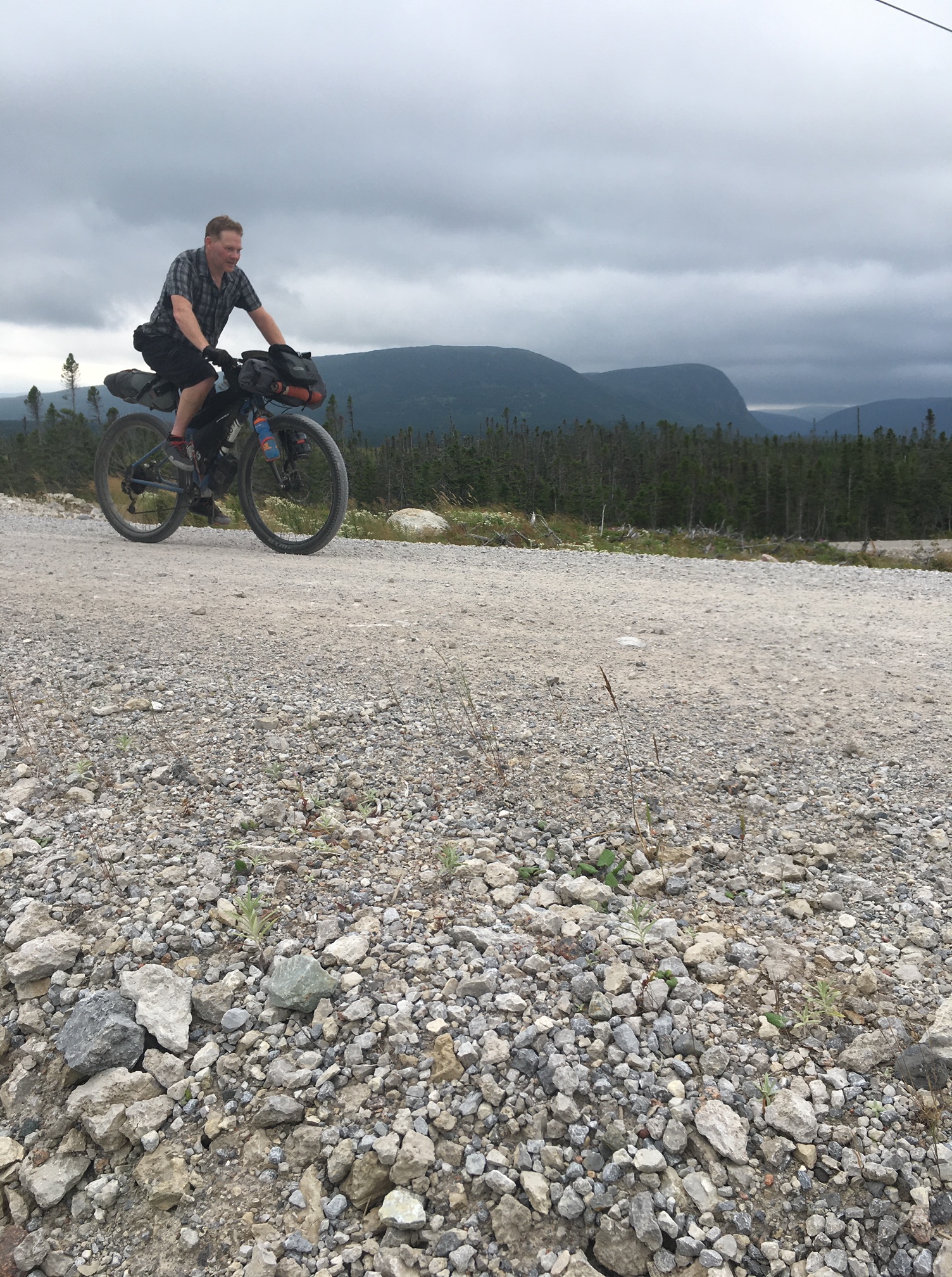
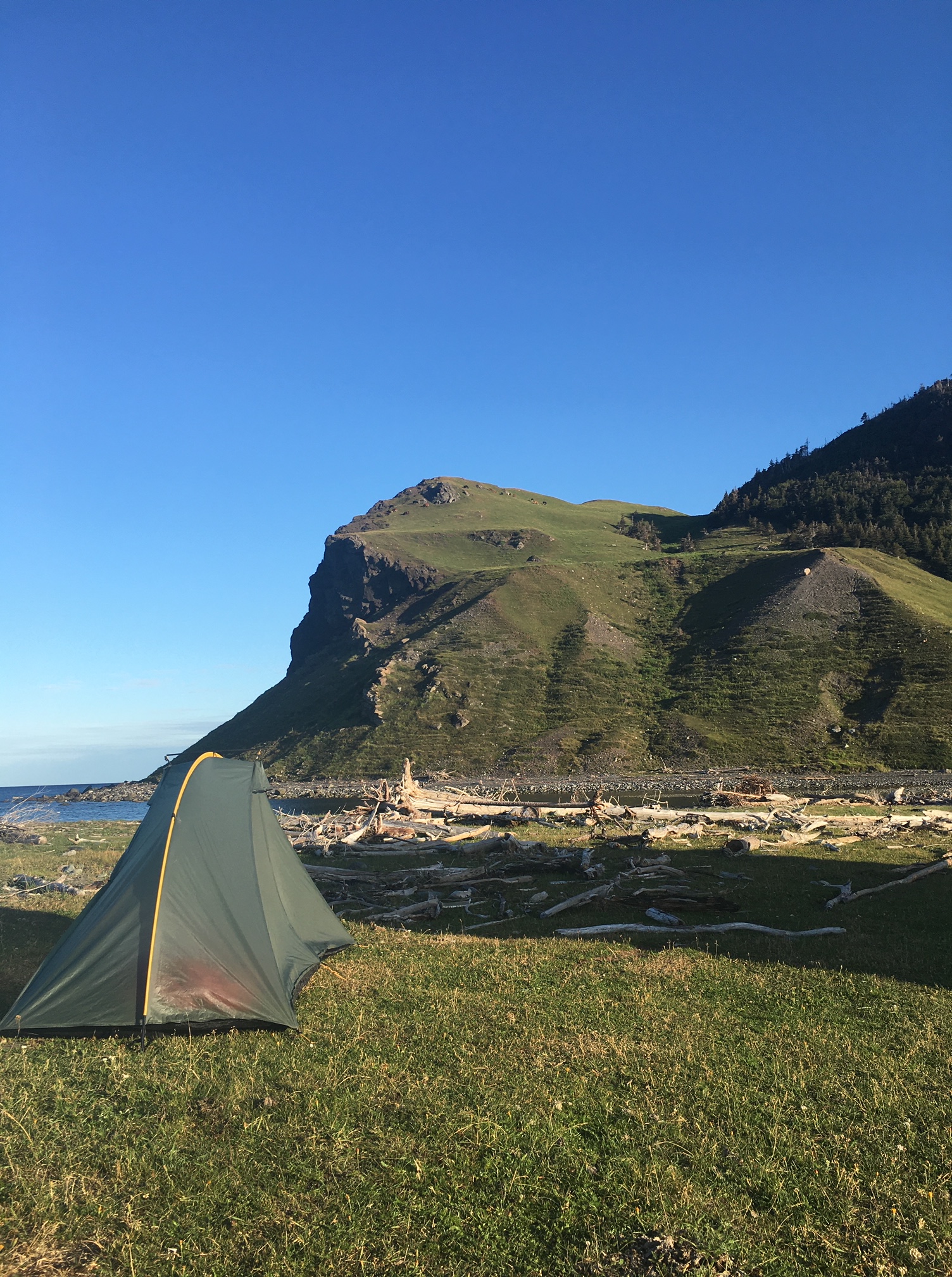
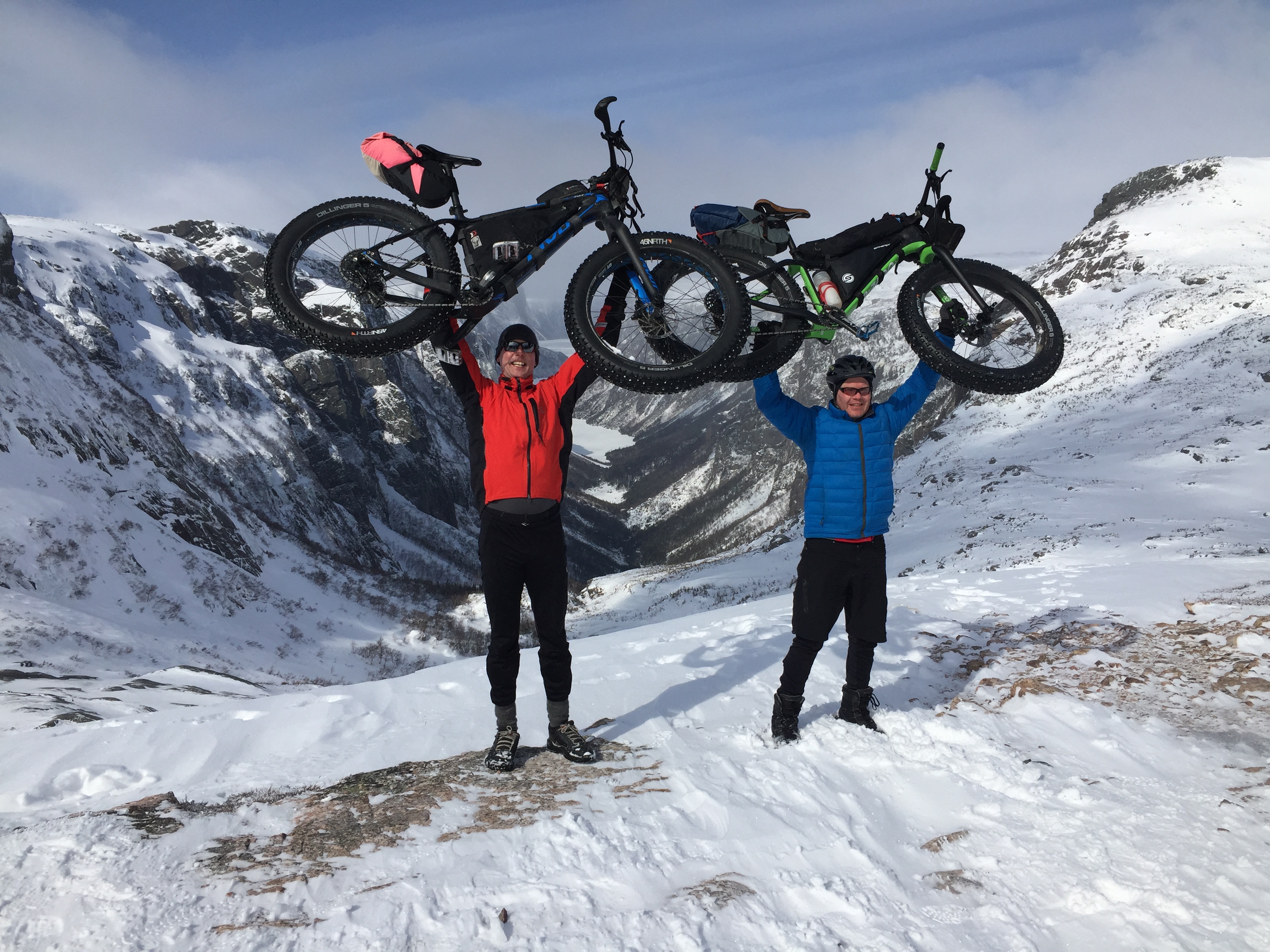
I’ve got limited internet/computer access but I just wanted to post that Darren and I made it to Western Brook Pond (aka “The Gorge”) in Gros Morne National Park. Three days, two nights and 110 km total. I’ll update the blog with more pictures and details when I can.

winter s24o

S24O = sub-24 hour overnighter.  The idea – get out for a quick trip – adventure doesn’t always have to be epic.

The plan was for us to head inland, to camp in the barrens.  But nature had other ideas; it warmed up considerably on Saturday and our planned route was mud.  So we headed toward the ocean, down the ever trusty Shoal Bay Road, where the woods keep the trail snow covered for longer.

My Pivot Les Fat, ready for action.  On the bars I have my full winter sleeping kit:  a Hilleberg Soulo tent, a -12C Western Mountaineering sleeping bag, a blue foamie and a Thermorest NeoAir sleeping pad.

My Pivot Les Fat, ready for action. On the bars I have my full winter sleeping kit: a Hilleberg Soulo tent, a -12C Western Mountaineering sleeping bag, a blue foamie and a Thermorest NeoAir sleeping pad.

The three bikes ready to roll.

The three bikes ready to roll.

What's a little bikepacking without a little hike-a-bike?

What’s a little bikepacking without a little hike-a-bike?

Our camping spot.

Our camping spot.

IMG_2578

Tim.

Tim.

Darren.

Darren.

This was a little dry run for Darren and I before we head to Gros Morne next week.  Stay tuned.

global fatbike day 2015

Wow.  Just wow.

Global Fatbike Day celebrations here in St. John’s just continue to grow and become increasingly popular.  In fact, we didn’t just celebrate with a day, we celebrated with a long weekend.  Here’s the quick version of how things went down here:

  • Thursday night: Fun ‘n’ Fast hosts an open house;
  • Friday: Mother Nature blesses us with 25 cm of fresh snow;
  • Saturday: group ride with beers and burgers after;
  • Sunday: huge turnout for our public event in Pippy Park.

Fun 'n' Fast gets the weekend rolling!

Fun ‘n’ Fast gets the weekend rolling!


After the 25 cm of snow on Friday a small group of us met at Steve H's on Saturday to celebrate the official Global Fatbike Day.

After the 25 cm of snow on Friday a small group of us met at Steve H’s on Saturday to celebrate the official Global Fatbike Day.

When in doubt, let it out. Soft conditions on Saturday meant looooow tire pressures.

When in doubt, let it out. Soft conditions on Saturday meant looooow tire pressures.

Mel showing off his new RSD "The Mayor".

Mel showing off his new RSD “The Mayor”.

Some guy named Guy styling it in the woods.

Some guy named Guy styling it in the woods.

Post-ride session in Steve's garage.

Post-ride session in Steve’s garage.

Sunday was the big event!

Sunday was the big event!

Canary Cycles and Cychotic brought lots of bikes for people to demo and drew huge crowds to their tent. That baby blue Stache 5 was te bike I really wanted to see. 29+ is in my future.

Canary Cycles and Cychotic brought lots of bikes for people to demo and drew huge crowds to their tent. That baby blue Stache 5 was the bike I really wanted to see. 29+ is in my future.

Fun 'n' Fast had bikes for people to demo up at North Bank Lodge.

Fun ‘n’ Fast had bikes for people to demo up at North Bank Lodge.

More than 40 people were on hand for the group ride around Pippy Park. Thanks to the efforts of Ross, Darren and Steve we had groomed trails to ride on.

More than 40 people were on hand for the group ride around Pippy Park. Thanks to the efforts of Ross, Darren and Steve we had groomed trails to ride on.

Going up!

Going up!

This year's ride even included a celebrity sighting - Jason Mamoa.

This year’s ride even included a celebrity sighting – Jason Momoa.

A pause in the woods to catch our breath.

A pause in the woods to catch our breath.

The after party at North Bank Lodge. Many thanks to Canary Cycles for providing the pizza!

The after party at North Bank Lodge. Many thanks to Canary Cycles for providing the pizza!


big o manufacturing fenders

St. John’s, Newfoundland is a wet, windy and cold place.  These factors combine to make riding here challenging.  Over the years I’ve figured out ways to eliminate the excuses for not riding – proper clothing, for instance, or DIY tire studding when the trails turned to nothing but ice.  Now I have eliminated one more excuse:  “the trails are too wet”.  Enter full fenders for fatbikes.

Big O Manufacturing fenders get strong reviews on-line so I took the plunge.  They don’t come cheap:  listed at $115 USD for the ones to fit my Pugsley they also charged a flat rate of $60 USD for shipping.  Gulp.  The good news was that after my order was shipped I was refunded $20 USD shipping overcharge.  So, to my door the fenders cost me $225 CDN.  They arrived in less than 10 days.

The fenders and hardware arrived nicely secured in the box.

The fenders and hardware arrived nicely secured in the box.

The quality of the materials is evident; the fenders are strong but flexible, the brackets are quality aluminum and the hardware stainless steel.  The instructions could be a bit better, but that’s a minor quibble.  The front fender requires you to drill two holes and the rear three.  Start to finish for me was about 1.5 hours.

Here is the finished product.

Here is the finished product.

We had just been through a couple of very wet and cold November weeks so the conditions to put these to the test were perfect.  I headed out for a two hour gravel grind on the back roads in The Goulds.  The results were everything I could hope for.  The fenders were solid, they did not rattle and I stayed very clean and dry.

Typical Goulds back road conditions: wet and muddy.

Typical Goulds back road conditions: wet and muddy.

Before fenders legs typically look like this.

Before fenders legs typically look like this.

After fenders. This is what my legs looked like after two hours in very wet andmuddy conditions.

After fenders. This is what my legs looked like after two hours in very wet and muddy conditions.